You are here: Home > Network List > US - United States National Seismic Network Stations List
> Station HAWA Hanford, Washington, USA > Earthquake Result Viewer
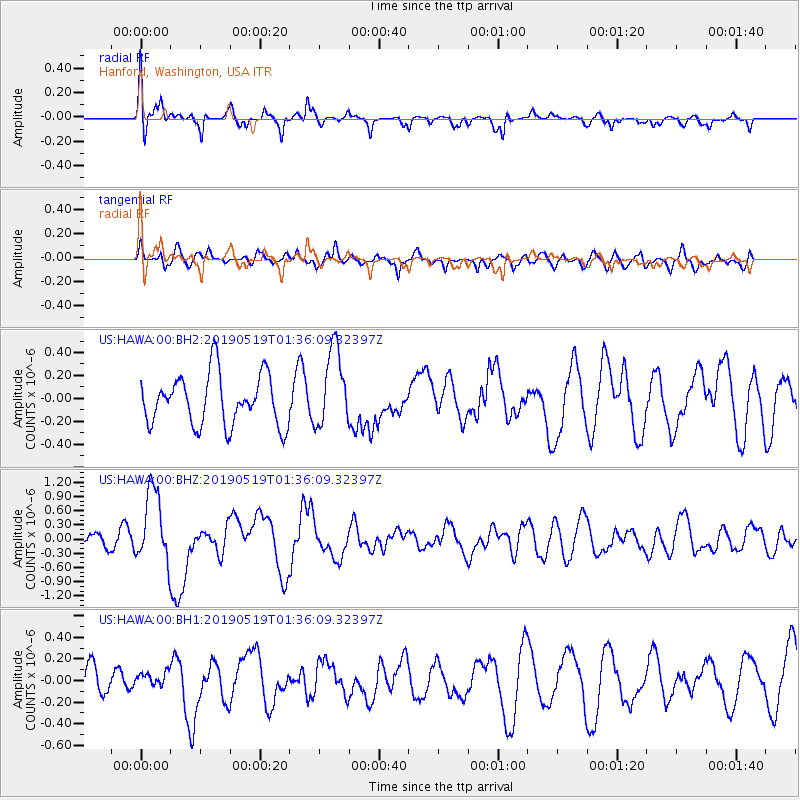
HAWA Hanford, Washington, USA - Earthquake Result Viewer
*The percent match for this event was below the threshold and hence no stack was calculated.
| Earthquake location: |
Southeast Of Loyalty Islands |
| Earthquake latitude/longitude: |
-21.7/169.8 |
| Earthquake time(UTC): |
2019/05/19 (139) 01:23:29 GMT |
| Earthquake Depth: |
20 km |
| Earthquake Magnitude: |
6.3 mww |
| Earthquake Catalog/Contributor: |
NEIC PDE/us |
|
| Network: |
US United States National Seismic Network |
| Station: |
HAWA Hanford, Washington, USA |
| Lat/Lon: |
46.39 N/119.53 W |
| Elevation: |
364 m |
|
| Distance: |
93.0 deg |
| Az: |
40.842 deg |
| Baz: |
241.507 deg |
| Ray Param: |
$rayparam |
*The percent match for this event was below the threshold and hence was not used in the summary stack. |
|
| Radial Match: |
61.755928 % |
| Radial Bump: |
400 |
| Transverse Match: |
57.989944 % |
| Transverse Bump: |
400 |
| SOD ConfigId: |
18369291 |
| Insert Time: |
2019-06-02 01:30:17.263 +0000 |
| GWidth: |
2.5 |
| Max Bumps: |
400 |
| Tol: |
0.001 |
|
Signal To Noise
| Channel | StoN | STA | LTA |
| US:HAWA:00:BHZ:20190519T01:36:09.32397Z | 5.0895405 | 7.696293E-7 | 1.5121783E-7 |
| US:HAWA:00:BH1:20190519T01:36:09.32397Z | 0.43105012 | 6.448321E-8 | 1.4959562E-7 |
| US:HAWA:00:BH2:20190519T01:36:09.32397Z | 1.5568582 | 3.4220932E-7 | 2.1980765E-7 |
| Arrivals |
| Ps | |
| PpPs | |
| PsPs/PpSs | |


