You are here: Home > Network List > US - United States National Seismic Network Stations List
> Station MNTX Cornudas Mountains, Texas, USA > Earthquake Result Viewer
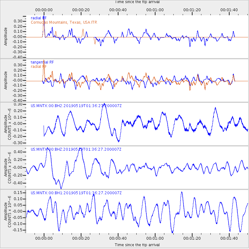
MNTX Cornudas Mountains, Texas, USA - Earthquake Result Viewer
*The percent match for this event was below the threshold and hence no stack was calculated.
| Earthquake location: |
Southeast Of Loyalty Islands |
| Earthquake latitude/longitude: |
-21.7/169.8 |
| Earthquake time(UTC): |
2019/05/19 (139) 01:23:29 GMT |
| Earthquake Depth: |
20 km |
| Earthquake Magnitude: |
6.3 mww |
| Earthquake Catalog/Contributor: |
NEIC PDE/us |
|
| Network: |
US United States National Seismic Network |
| Station: |
MNTX Cornudas Mountains, Texas, USA |
| Lat/Lon: |
31.70 N/105.38 W |
| Elevation: |
404 m |
|
| Distance: |
96.9 deg |
| Az: |
58.773 deg |
| Baz: |
248.929 deg |
| Ray Param: |
$rayparam |
*The percent match for this event was below the threshold and hence was not used in the summary stack. |
|
| Radial Match: |
55.543633 % |
| Radial Bump: |
363 |
| Transverse Match: |
48.613815 % |
| Transverse Bump: |
400 |
| SOD ConfigId: |
18369291 |
| Insert Time: |
2019-06-02 01:30:18.707 +0000 |
| GWidth: |
2.5 |
| Max Bumps: |
400 |
| Tol: |
0.001 |
|
Signal To Noise
| Channel | StoN | STA | LTA |
| US:MNTX:00:BHZ:20190519T01:36:27.200007Z | 2.7842407 | 3.1327414E-7 | 1.125169E-7 |
| US:MNTX:00:BH1:20190519T01:36:27.200007Z | 1.0457475 | 7.013075E-8 | 6.706279E-8 |
| US:MNTX:00:BH2:20190519T01:36:27.200007Z | 2.1635725 | 2.1831337E-7 | 1.0090411E-7 |
| Arrivals |
| Ps | |
| PpPs | |
| PsPs/PpSs | |


