You are here: Home > Network List > UW - Pacific Northwest Regional Seismic Network Stations List
> Station UMAT Pilot Rock, OR, USA > Earthquake Result Viewer
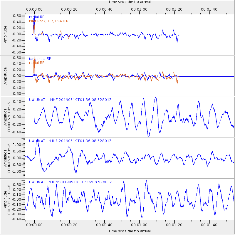
UMAT Pilot Rock, OR, USA - Earthquake Result Viewer
*The percent match for this event was below the threshold and hence no stack was calculated.
| Earthquake location: |
Southeast Of Loyalty Islands |
| Earthquake latitude/longitude: |
-21.7/169.8 |
| Earthquake time(UTC): |
2019/05/19 (139) 01:23:29 GMT |
| Earthquake Depth: |
20 km |
| Earthquake Magnitude: |
6.3 mww |
| Earthquake Catalog/Contributor: |
NEIC PDE/us |
|
| Network: |
UW Pacific Northwest Regional Seismic Network |
| Station: |
UMAT Pilot Rock, OR, USA |
| Lat/Lon: |
45.29 N/118.96 W |
| Elevation: |
1318 m |
|
| Distance: |
92.8 deg |
| Az: |
42.004 deg |
| Baz: |
241.858 deg |
| Ray Param: |
$rayparam |
*The percent match for this event was below the threshold and hence was not used in the summary stack. |
|
| Radial Match: |
68.31649 % |
| Radial Bump: |
400 |
| Transverse Match: |
57.40865 % |
| Transverse Bump: |
397 |
| SOD ConfigId: |
18369291 |
| Insert Time: |
2019-06-02 01:30:53.096 +0000 |
| GWidth: |
2.5 |
| Max Bumps: |
400 |
| Tol: |
0.001 |
|
Signal To Noise
| Channel | StoN | STA | LTA |
| UW:UMAT: :HHZ:20190519T01:36:08.52801Z | 3.794707 | 7.738175E-7 | 2.0392021E-7 |
| UW:UMAT: :HHN:20190519T01:36:08.52801Z | 0.94207215 | 7.736188E-8 | 8.2118845E-8 |
| UW:UMAT: :HHE:20190519T01:36:08.52801Z | 1.2697201 | 2.0816753E-7 | 1.6394759E-7 |
| Arrivals |
| Ps | |
| PpPs | |
| PsPs/PpSs | |


