You are here: Home > Network List > TA - USArray Transportable Network (new EarthScope stations) Stations List
> Station I18A Diamond G Ranch, Dubois, WY, USA > Earthquake Result Viewer
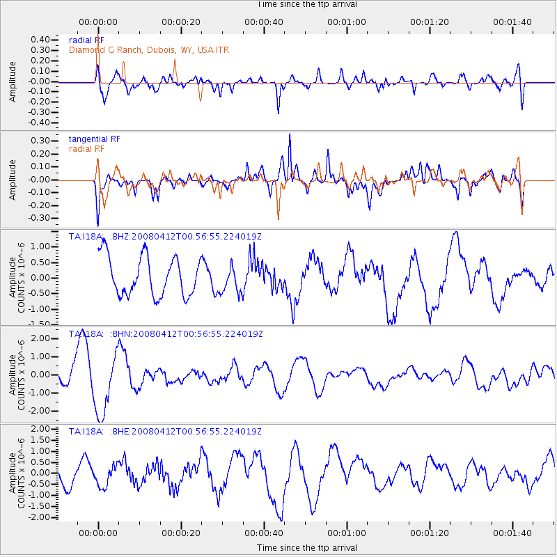
I18A Diamond G Ranch, Dubois, WY, USA - Earthquake Result Viewer
*The percent match for this event was below the threshold and hence no stack was calculated.
| Earthquake location: |
Kuril Islands |
| Earthquake latitude/longitude: |
43.9/147.5 |
| Earthquake time(UTC): |
2008/04/12 (103) 00:46:28 GMT |
| Earthquake Depth: |
64 km |
| Earthquake Magnitude: |
5.7 MB |
| Earthquake Catalog/Contributor: |
WHDF/NEIC |
|
| Network: |
TA USArray Transportable Network (new EarthScope stations) |
| Station: |
I18A Diamond G Ranch, Dubois, WY, USA |
| Lat/Lon: |
43.70 N/109.82 W |
| Elevation: |
2322 m |
|
| Distance: |
68.9 deg |
| Az: |
49.336 deg |
| Baz: |
310.86 deg |
| Ray Param: |
$rayparam |
*The percent match for this event was below the threshold and hence was not used in the summary stack. |
|
| Radial Match: |
66.8222 % |
| Radial Bump: |
400 |
| Transverse Match: |
73.55362 % |
| Transverse Bump: |
326 |
| SOD ConfigId: |
2504 |
| Insert Time: |
2010-03-06 22:42:10.300 +0000 |
| GWidth: |
2.5 |
| Max Bumps: |
400 |
| Tol: |
0.001 |
|
Signal To Noise
| Channel | StoN | STA | LTA |
| TA:I18A: :BHN:20080412T00:56:55.224019Z | 1.7222277 | 1.7307772E-6 | 1.0049641E-6 |
| TA:I18A: :BHE:20080412T00:56:55.224019Z | 1.1008519 | 4.863781E-7 | 4.4181974E-7 |
| TA:I18A: :BHZ:20080412T00:56:55.224019Z | 0.69884217 | 4.371789E-7 | 6.2557604E-7 |
| Arrivals |
| Ps | |
| PpPs | |
| PsPs/PpSs | |


