You are here: Home > Network List > CI - Caltech Regional Seismic Network Stations List
> Station MPM Manuel Prospect Mine, California, USA > Earthquake Result Viewer
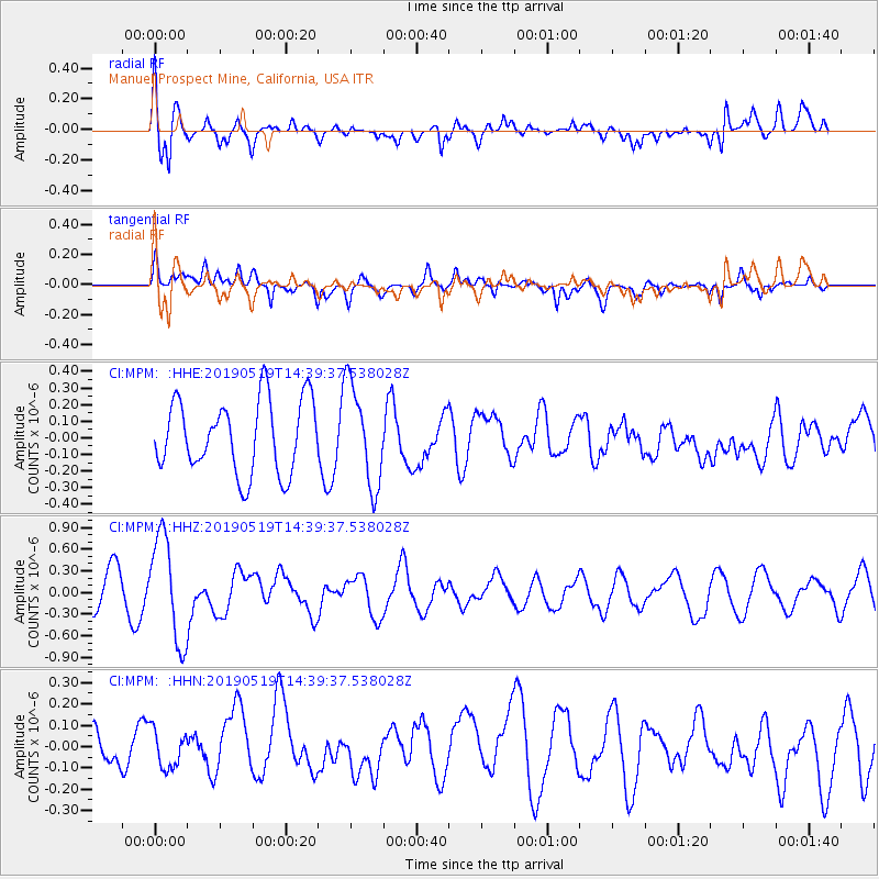
MPM Manuel Prospect Mine, California, USA - Earthquake Result Viewer
*The percent match for this event was below the threshold and hence no stack was calculated.
| Earthquake location: |
Southeast Of Loyalty Islands |
| Earthquake latitude/longitude: |
-21.7/169.6 |
| Earthquake time(UTC): |
2019/05/19 (139) 14:27:10 GMT |
| Earthquake Depth: |
10 km |
| Earthquake Magnitude: |
5.9 Mww |
| Earthquake Catalog/Contributor: |
NEIC PDE/us |
|
| Network: |
CI Caltech Regional Seismic Network |
| Station: |
MPM Manuel Prospect Mine, California, USA |
| Lat/Lon: |
36.06 N/117.49 W |
| Elevation: |
185 m |
|
| Distance: |
89.7 deg |
| Az: |
50.776 deg |
| Baz: |
242.738 deg |
| Ray Param: |
$rayparam |
*The percent match for this event was below the threshold and hence was not used in the summary stack. |
|
| Radial Match: |
58.947277 % |
| Radial Bump: |
400 |
| Transverse Match: |
70.24785 % |
| Transverse Bump: |
400 |
| SOD ConfigId: |
18369291 |
| Insert Time: |
2019-06-02 14:29:11.617 +0000 |
| GWidth: |
2.5 |
| Max Bumps: |
400 |
| Tol: |
0.001 |
|
Signal To Noise
| Channel | StoN | STA | LTA |
| CI:MPM: :HHZ:20190519T14:39:37.538028Z | 3.486205 | 7.251928E-7 | 2.0801784E-7 |
| CI:MPM: :HHN:20190519T14:39:37.538028Z | 0.8707162 | 8.78262E-8 | 1.0086662E-7 |
| CI:MPM: :HHE:20190519T14:39:37.538028Z | 1.3845512 | 3.0277508E-7 | 2.1868102E-7 |
| Arrivals |
| Ps | |
| PpPs | |
| PsPs/PpSs | |


