You are here: Home > Network List > TA - USArray Transportable Network (new EarthScope stations) Stations List
> Station I18A Diamond G Ranch, Dubois, WY, USA > Earthquake Result Viewer
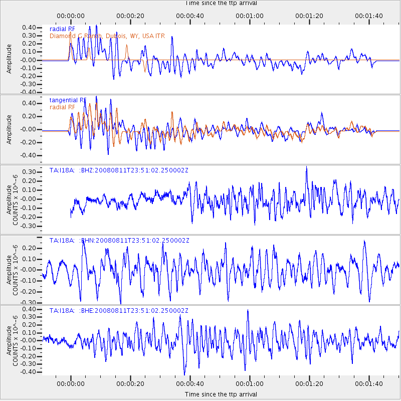
I18A Diamond G Ranch, Dubois, WY, USA - Earthquake Result Viewer
*The percent match for this event was below the threshold and hence no stack was calculated.
| Earthquake location: |
Central Mid-Atlantic Ridge |
| Earthquake latitude/longitude: |
-1.0/-21.8 |
| Earthquake time(UTC): |
2008/08/11 (224) 23:38:38 GMT |
| Earthquake Depth: |
13 km |
| Earthquake Magnitude: |
6.0 MW, 5.2 MS, 5.4 MB, 6.0 MW |
| Earthquake Catalog/Contributor: |
WHDF/NEIC |
|
| Network: |
TA USArray Transportable Network (new EarthScope stations) |
| Station: |
I18A Diamond G Ranch, Dubois, WY, USA |
| Lat/Lon: |
43.70 N/109.82 W |
| Elevation: |
2322 m |
|
| Distance: |
89.2 deg |
| Az: |
313.541 deg |
| Baz: |
92.13 deg |
| Ray Param: |
$rayparam |
*The percent match for this event was below the threshold and hence was not used in the summary stack. |
|
| Radial Match: |
52.24741 % |
| Radial Bump: |
400 |
| Transverse Match: |
69.228676 % |
| Transverse Bump: |
400 |
| SOD ConfigId: |
2504 |
| Insert Time: |
2010-03-06 22:42:29.832 +0000 |
| GWidth: |
2.5 |
| Max Bumps: |
400 |
| Tol: |
0.001 |
|
Signal To Noise
| Channel | StoN | STA | LTA |
| TA:I18A: :BHN:20080811T23:51:02.250002Z | 3.6883192 | 1.3964939E-7 | 3.786261E-8 |
| TA:I18A: :BHE:20080811T23:51:02.250002Z | 1.013938 | 6.134359E-8 | 6.050034E-8 |
| TA:I18A: :BHZ:20080811T23:51:02.250002Z | 1.4451491 | 7.785259E-8 | 5.3871666E-8 |
| Arrivals |
| Ps | |
| PpPs | |
| PsPs/PpSs | |


