You are here: Home > Network List > TA - USArray Transportable Network (new EarthScope stations) Stations List
> Station I18A Diamond G Ranch, Dubois, WY, USA > Earthquake Result Viewer
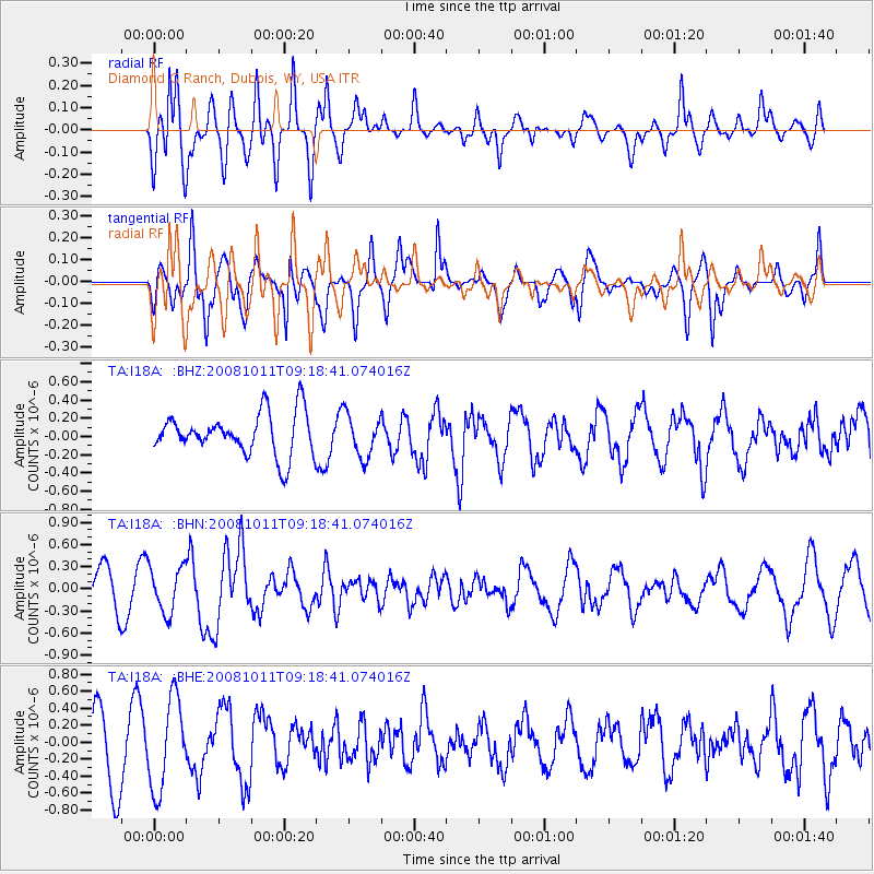
I18A Diamond G Ranch, Dubois, WY, USA - Earthquake Result Viewer
*The percent match for this event was below the threshold and hence no stack was calculated.
| Earthquake location: |
Eastern Caucasus |
| Earthquake latitude/longitude: |
43.4/46.3 |
| Earthquake time(UTC): |
2008/10/11 (285) 09:06:10 GMT |
| Earthquake Depth: |
16 km |
| Earthquake Magnitude: |
5.6 MB, 5.5 MS, 5.8 MW, 5.7 MW |
| Earthquake Catalog/Contributor: |
WHDF/NEIC |
|
| Network: |
TA USArray Transportable Network (new EarthScope stations) |
| Station: |
I18A Diamond G Ranch, Dubois, WY, USA |
| Lat/Lon: |
43.70 N/109.82 W |
| Elevation: |
2322 m |
|
| Distance: |
90.7 deg |
| Az: |
342.891 deg |
| Baz: |
17.205 deg |
| Ray Param: |
$rayparam |
*The percent match for this event was below the threshold and hence was not used in the summary stack. |
|
| Radial Match: |
80.68941 % |
| Radial Bump: |
400 |
| Transverse Match: |
65.25599 % |
| Transverse Bump: |
384 |
| SOD ConfigId: |
2556 |
| Insert Time: |
2010-03-06 22:42:32.236 +0000 |
| GWidth: |
2.5 |
| Max Bumps: |
400 |
| Tol: |
0.001 |
|
Signal To Noise
| Channel | StoN | STA | LTA |
| TA:I18A: :BHN:20081011T09:18:41.074016Z | 0.87140834 | 3.0603834E-7 | 3.511997E-7 |
| TA:I18A: :BHE:20081011T09:18:41.074016Z | 1.6316959 | 5.3550644E-7 | 3.281901E-7 |
| TA:I18A: :BHZ:20081011T09:18:41.074016Z | 1.0152719 | 2.3129482E-7 | 2.2781565E-7 |
| Arrivals |
| Ps | |
| PpPs | |
| PsPs/PpSs | |


