You are here: Home > Network List > TA - USArray Transportable Network (new EarthScope stations) Stations List
> Station D23K Nanushuk River, AK USA > Earthquake Result Viewer
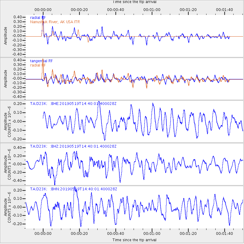
D23K Nanushuk River, AK USA - Earthquake Result Viewer
*The percent match for this event was below the threshold and hence no stack was calculated.
| Earthquake location: |
Southeast Of Loyalty Islands |
| Earthquake latitude/longitude: |
-21.7/169.6 |
| Earthquake time(UTC): |
2019/05/19 (139) 14:27:10 GMT |
| Earthquake Depth: |
10 km |
| Earthquake Magnitude: |
5.9 Mww |
| Earthquake Catalog/Contributor: |
NEIC PDE/us |
|
| Network: |
TA USArray Transportable Network (new EarthScope stations) |
| Station: |
D23K Nanushuk River, AK USA |
| Lat/Lon: |
68.97 N/150.68 W |
| Elevation: |
406 m |
|
| Distance: |
94.9 deg |
| Az: |
13.399 deg |
| Baz: |
216.64 deg |
| Ray Param: |
$rayparam |
*The percent match for this event was below the threshold and hence was not used in the summary stack. |
|
| Radial Match: |
57.69608 % |
| Radial Bump: |
400 |
| Transverse Match: |
49.67621 % |
| Transverse Bump: |
400 |
| SOD ConfigId: |
18369291 |
| Insert Time: |
2019-06-02 14:31:05.775 +0000 |
| GWidth: |
2.5 |
| Max Bumps: |
400 |
| Tol: |
0.001 |
|
Signal To Noise
| Channel | StoN | STA | LTA |
| TA:D23K: :BHZ:20190519T14:40:01.400028Z | 1.7360146 | 1.9286693E-7 | 1.1109753E-7 |
| TA:D23K: :BHN:20190519T14:40:01.400028Z | 2.506162 | 1.2793522E-7 | 5.1048268E-8 |
| TA:D23K: :BHE:20190519T14:40:01.400028Z | 2.19257 | 1.4166866E-7 | 6.461306E-8 |
| Arrivals |
| Ps | |
| PpPs | |
| PsPs/PpSs | |


