You are here: Home > Network List > TA - USArray Transportable Network (new EarthScope stations) Stations List
> Station O17K Koliganek, Bristol Bay, AK, USA > Earthquake Result Viewer
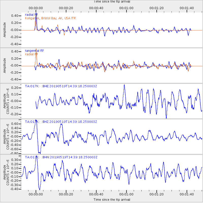
O17K Koliganek, Bristol Bay, AK, USA - Earthquake Result Viewer
*The percent match for this event was below the threshold and hence no stack was calculated.
| Earthquake location: |
Southeast Of Loyalty Islands |
| Earthquake latitude/longitude: |
-21.7/169.6 |
| Earthquake time(UTC): |
2019/05/19 (139) 14:27:10 GMT |
| Earthquake Depth: |
10 km |
| Earthquake Magnitude: |
5.9 Mww |
| Earthquake Catalog/Contributor: |
NEIC PDE/us |
|
| Network: |
TA USArray Transportable Network (new EarthScope stations) |
| Station: |
O17K Koliganek, Bristol Bay, AK, USA |
| Lat/Lon: |
59.77 N/157.09 W |
| Elevation: |
156 m |
|
| Distance: |
85.7 deg |
| Az: |
16.193 deg |
| Baz: |
210.831 deg |
| Ray Param: |
$rayparam |
*The percent match for this event was below the threshold and hence was not used in the summary stack. |
|
| Radial Match: |
75.089096 % |
| Radial Bump: |
400 |
| Transverse Match: |
64.886734 % |
| Transverse Bump: |
400 |
| SOD ConfigId: |
18369291 |
| Insert Time: |
2019-06-02 14:32:04.049 +0000 |
| GWidth: |
2.5 |
| Max Bumps: |
400 |
| Tol: |
0.001 |
|
Signal To Noise
| Channel | StoN | STA | LTA |
| TA:O17K: :BHZ:20190519T14:39:18.250003Z | 8.339976 | 5.792785E-7 | 6.9458046E-8 |
| TA:O17K: :BHN:20190519T14:39:18.250003Z | 3.0603561 | 2.583229E-7 | 8.440943E-8 |
| TA:O17K: :BHE:20190519T14:39:18.250003Z | 1.3623024 | 6.083815E-8 | 4.4658325E-8 |
| Arrivals |
| Ps | |
| PpPs | |
| PsPs/PpSs | |


