You are here: Home > Network List > TA - USArray Transportable Network (new EarthScope stations) Stations List
> Station P17K Kvichak River, AK, USA > Earthquake Result Viewer
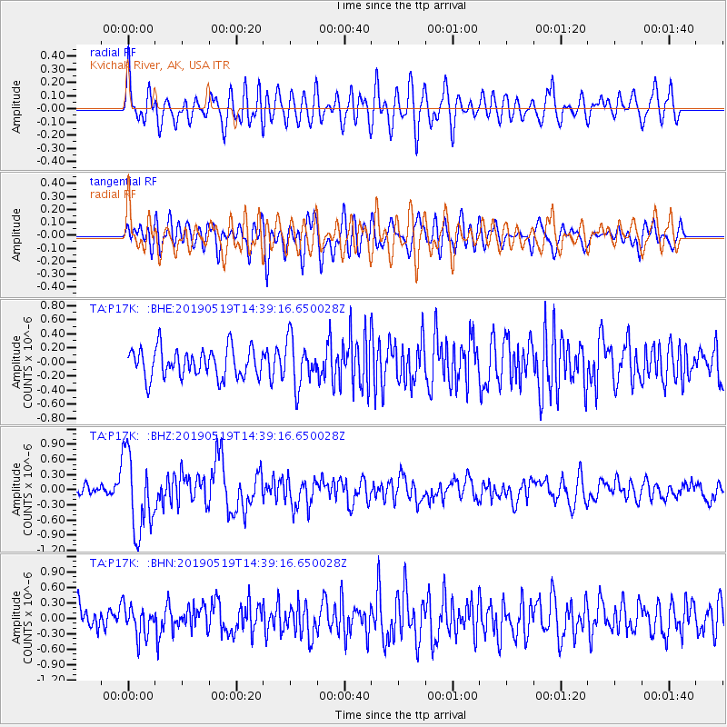
P17K Kvichak River, AK, USA - Earthquake Result Viewer
*The percent match for this event was below the threshold and hence no stack was calculated.
| Earthquake location: |
Southeast Of Loyalty Islands |
| Earthquake latitude/longitude: |
-21.7/169.6 |
| Earthquake time(UTC): |
2019/05/19 (139) 14:27:10 GMT |
| Earthquake Depth: |
10 km |
| Earthquake Magnitude: |
5.9 Mww |
| Earthquake Catalog/Contributor: |
NEIC PDE/us |
|
| Network: |
TA USArray Transportable Network (new EarthScope stations) |
| Station: |
P17K Kvichak River, AK, USA |
| Lat/Lon: |
59.20 N/156.44 W |
| Elevation: |
91 m |
|
| Distance: |
85.3 deg |
| Az: |
16.781 deg |
| Baz: |
211.44 deg |
| Ray Param: |
$rayparam |
*The percent match for this event was below the threshold and hence was not used in the summary stack. |
|
| Radial Match: |
71.705696 % |
| Radial Bump: |
400 |
| Transverse Match: |
53.087837 % |
| Transverse Bump: |
400 |
| SOD ConfigId: |
18369291 |
| Insert Time: |
2019-06-02 14:32:08.109 +0000 |
| GWidth: |
2.5 |
| Max Bumps: |
400 |
| Tol: |
0.001 |
|
Signal To Noise
| Channel | StoN | STA | LTA |
| TA:P17K: :BHZ:20190519T14:39:16.650028Z | 7.4927835 | 7.716094E-7 | 1.0298034E-7 |
| TA:P17K: :BHN:20190519T14:39:16.650028Z | 1.2562574 | 2.8660978E-7 | 2.2814574E-7 |
| TA:P17K: :BHE:20190519T14:39:16.650028Z | 1.6035914 | 3.2656405E-7 | 2.0364541E-7 |
| Arrivals |
| Ps | |
| PpPs | |
| PsPs/PpSs | |


