You are here: Home > Network List > TS - TERRAscope (Southern California Seismic Network) Stations List
> Station GLA Glamis, California, USA > Earthquake Result Viewer
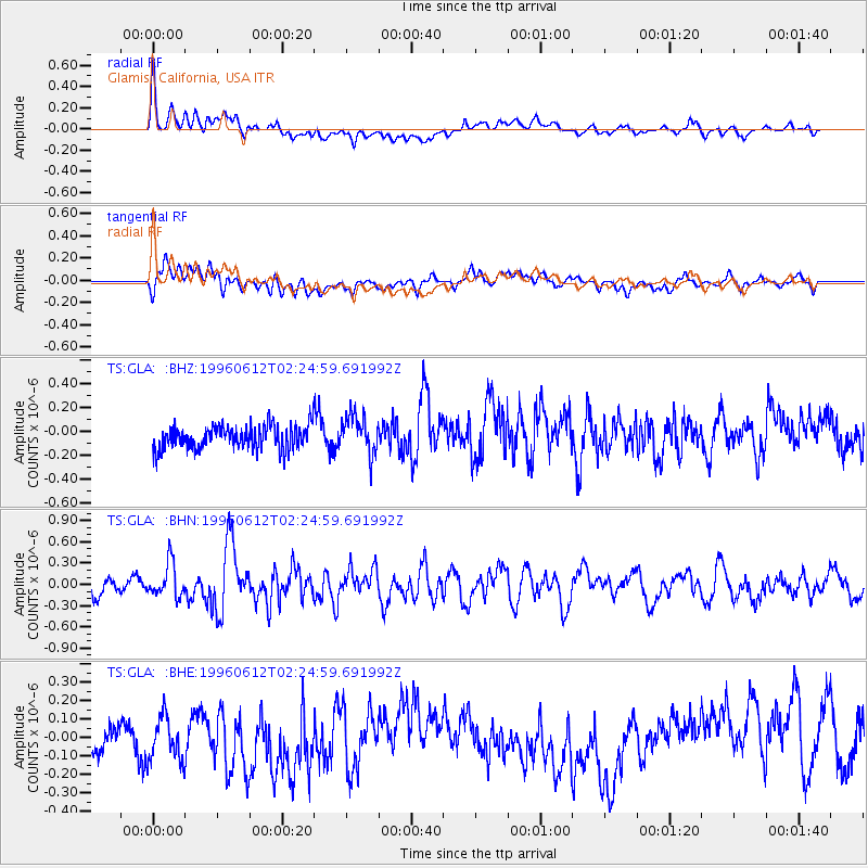
GLA Glamis, California, USA - Earthquake Result Viewer
*The percent match for this event was below the threshold and hence no stack was calculated.
| Earthquake location: |
Andreanof Islands, Aleutian Is. |
| Earthquake latitude/longitude: |
51.4/-178.2 |
| Earthquake time(UTC): |
1996/06/12 (164) 02:16:48 GMT |
| Earthquake Depth: |
33 km |
| Earthquake Magnitude: |
5.5 MB, 5.3 MS, 5.7 UNKNOWN, 5.6 ML |
| Earthquake Catalog/Contributor: |
WHDF/NEIC |
|
| Network: |
TS TERRAscope (Southern California Seismic Network) |
| Station: |
GLA Glamis, California, USA |
| Lat/Lon: |
33.05 N/114.83 W |
| Elevation: |
627 m |
|
| Distance: |
48.8 deg |
| Az: |
86.451 deg |
| Baz: |
311.914 deg |
| Ray Param: |
$rayparam |
*The percent match for this event was below the threshold and hence was not used in the summary stack. |
|
| Radial Match: |
64.70856 % |
| Radial Bump: |
400 |
| Transverse Match: |
52.02515 % |
| Transverse Bump: |
400 |
| SOD ConfigId: |
4480 |
| Insert Time: |
2010-02-26 14:13:43.157 +0000 |
| GWidth: |
2.5 |
| Max Bumps: |
400 |
| Tol: |
0.001 |
|
Signal To Noise
| Channel | StoN | STA | LTA |
| TS:GLA: :BHN:19960612T02:24:59.691992Z | 2.1611447 | 2.403238E-7 | 1.11202084E-7 |
| TS:GLA: :BHE:19960612T02:24:59.691992Z | 1.4017297 | 1.344586E-7 | 9.592334E-8 |
| TS:GLA: :BHZ:19960612T02:24:59.691992Z | 1.7310511 | 1.6629234E-7 | 9.606437E-8 |
| Arrivals |
| Ps | |
| PpPs | |
| PsPs/PpSs | |


