You are here: Home > Network List > TA - USArray Transportable Network (new EarthScope stations) Stations List
> Station D25K Kavik River, AK, USA > Earthquake Result Viewer
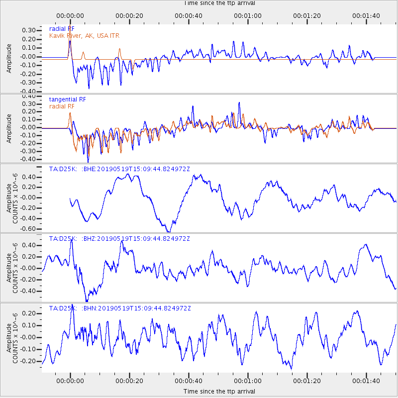
D25K Kavik River, AK, USA - Earthquake Result Viewer
*The percent match for this event was below the threshold and hence no stack was calculated.
| Earthquake location: |
Southeast Of Loyalty Islands |
| Earthquake latitude/longitude: |
-21.6/169.5 |
| Earthquake time(UTC): |
2019/05/19 (139) 14:56:50 GMT |
| Earthquake Depth: |
20 km |
| Earthquake Magnitude: |
6.3 mww |
| Earthquake Catalog/Contributor: |
NEIC PDE/us |
|
| Network: |
TA USArray Transportable Network (new EarthScope stations) |
| Station: |
D25K Kavik River, AK, USA |
| Lat/Lon: |
69.32 N/146.38 W |
| Elevation: |
770 m |
|
| Distance: |
96.0 deg |
| Az: |
14.407 deg |
| Baz: |
220.682 deg |
| Ray Param: |
$rayparam |
*The percent match for this event was below the threshold and hence was not used in the summary stack. |
|
| Radial Match: |
66.66959 % |
| Radial Bump: |
400 |
| Transverse Match: |
56.400368 % |
| Transverse Bump: |
399 |
| SOD ConfigId: |
18369291 |
| Insert Time: |
2019-06-02 15:00:55.884 +0000 |
| GWidth: |
2.5 |
| Max Bumps: |
400 |
| Tol: |
0.001 |
|
Signal To Noise
| Channel | StoN | STA | LTA |
| TA:D25K: :BHZ:20190519T15:09:44.824972Z | 2.7528799 | 2.4422172E-7 | 8.8715E-8 |
| TA:D25K: :BHN:20190519T15:09:44.824972Z | 1.0135704 | 1.2542004E-7 | 1.2374082E-7 |
| TA:D25K: :BHE:20190519T15:09:44.824972Z | 1.8295498 | 5.654515E-7 | 3.090659E-7 |
| Arrivals |
| Ps | |
| PpPs | |
| PsPs/PpSs | |


