You are here: Home > Network List > TA - USArray Transportable Network (new EarthScope stations) Stations List
> Station N21A Black Mountain, Craig, CO, USA > Earthquake Result Viewer
N21A Black Mountain, Craig, CO, USA - Earthquake Result Viewer

| Earthquake location: |
Off East Coast Of Honshu, Japan |
| Earthquake latitude/longitude: |
37.6/142.2 |
| Earthquake time(UTC): |
2008/07/19 (201) 02:39:28 GMT |
| Earthquake Depth: |
22 km |
| Earthquake Magnitude: |
6.2 MB, 7.0 MS, 7.0 MW, 6.9 MW |
| Earthquake Catalog/Contributor: |
WHDF/NEIC |
|
| Network: |
TA USArray Transportable Network (new EarthScope stations) |
| Station: |
N21A Black Mountain, Craig, CO, USA |
| Lat/Lon: |
40.76 N/107.52 W |
| Elevation: |
2235 m |
|
| Distance: |
79.3 deg |
| Az: |
46.484 deg |
| Baz: |
310.646 deg |
| Ray Param: |
0.049030054 |
| Estimated Moho Depth: |
51.0 km |
| Estimated Crust Vp/Vs: |
1.98 |
| Assumed Crust Vp: |
6.159 km/s |
| Estimated Crust Vs: |
3.114 km/s |
| Estimated Crust Poisson's Ratio: |
0.33 |
|
| Radial Match: |
95.05849 % |
| Radial Bump: |
400 |
| Transverse Match: |
85.28424 % |
| Transverse Bump: |
400 |
| SOD ConfigId: |
2504 |
| Insert Time: |
2010-03-06 22:44:55.039 +0000 |
| GWidth: |
2.5 |
| Max Bumps: |
400 |
| Tol: |
0.001 |
|
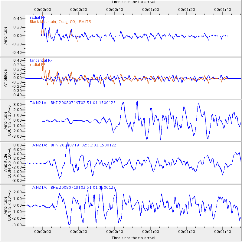
Signal To Noise
| Channel | StoN | STA | LTA |
| TA:N21A: :BHN:20080719T02:51:01.150012Z | 8.035562 | 6.7444677E-7 | 8.393275E-8 |
| TA:N21A: :BHE:20080719T02:51:01.150012Z | 1.894078 | 1.6074623E-7 | 8.486779E-8 |
| TA:N21A: :BHZ:20080719T02:51:01.150012Z | 1.9063392 | 3.2225887E-7 | 1.6904593E-7 |
| Arrivals |
| Ps | 8.3 SECOND |
| PpPs | 24 SECOND |
| PsPs/PpSs | 32 SECOND |


