You are here: Home > Network List > TA - USArray Transportable Network (new EarthScope stations) Stations List
> Station H16K Elim, AK, USA > Earthquake Result Viewer
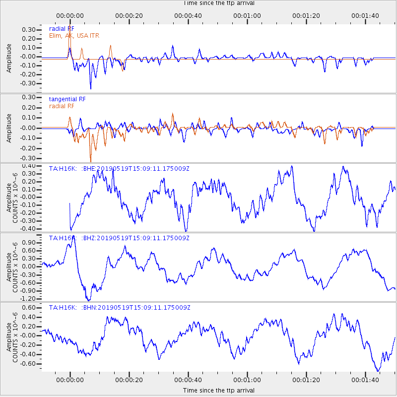
H16K Elim, AK, USA - Earthquake Result Viewer
*The percent match for this event was below the threshold and hence no stack was calculated.
| Earthquake location: |
Southeast Of Loyalty Islands |
| Earthquake latitude/longitude: |
-21.6/169.5 |
| Earthquake time(UTC): |
2019/05/19 (139) 14:56:50 GMT |
| Earthquake Depth: |
20 km |
| Earthquake Magnitude: |
6.3 mww |
| Earthquake Catalog/Contributor: |
NEIC PDE/us |
|
| Network: |
TA USArray Transportable Network (new EarthScope stations) |
| Station: |
H16K Elim, AK, USA |
| Lat/Lon: |
64.64 N/162.24 W |
| Elevation: |
216 m |
|
| Distance: |
88.7 deg |
| Az: |
11.782 deg |
| Baz: |
206.178 deg |
| Ray Param: |
$rayparam |
*The percent match for this event was below the threshold and hence was not used in the summary stack. |
|
| Radial Match: |
84.06968 % |
| Radial Bump: |
400 |
| Transverse Match: |
59.781914 % |
| Transverse Bump: |
400 |
| SOD ConfigId: |
18369291 |
| Insert Time: |
2019-06-02 15:01:17.714 +0000 |
| GWidth: |
2.5 |
| Max Bumps: |
400 |
| Tol: |
0.001 |
|
Signal To Noise
| Channel | StoN | STA | LTA |
| TA:H16K: :BHZ:20190519T15:09:11.175009Z | 4.247077 | 7.782801E-7 | 1.8325075E-7 |
| TA:H16K: :BHN:20190519T15:09:11.175009Z | 1.1905155 | 2.4974875E-7 | 2.0978203E-7 |
| TA:H16K: :BHE:20190519T15:09:11.175009Z | 0.6862822 | 1.4575518E-7 | 2.1238372E-7 |
| Arrivals |
| Ps | |
| PpPs | |
| PsPs/PpSs | |


