You are here: Home > Network List > TA - USArray Transportable Network (new EarthScope stations) Stations List
> Station I17K Unalakleet, AK, USA > Earthquake Result Viewer
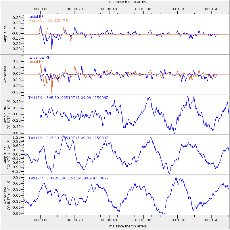
I17K Unalakleet, AK, USA - Earthquake Result Viewer
*The percent match for this event was below the threshold and hence no stack was calculated.
| Earthquake location: |
Southeast Of Loyalty Islands |
| Earthquake latitude/longitude: |
-21.6/169.5 |
| Earthquake time(UTC): |
2019/05/19 (139) 14:56:50 GMT |
| Earthquake Depth: |
20 km |
| Earthquake Magnitude: |
6.3 mww |
| Earthquake Catalog/Contributor: |
NEIC PDE/us |
|
| Network: |
TA USArray Transportable Network (new EarthScope stations) |
| Station: |
I17K Unalakleet, AK, USA |
| Lat/Lon: |
63.89 N/160.70 W |
| Elevation: |
105 m |
|
| Distance: |
88.3 deg |
| Az: |
12.724 deg |
| Baz: |
207.592 deg |
| Ray Param: |
$rayparam |
*The percent match for this event was below the threshold and hence was not used in the summary stack. |
|
| Radial Match: |
93.95819 % |
| Radial Bump: |
241 |
| Transverse Match: |
74.74466 % |
| Transverse Bump: |
400 |
| SOD ConfigId: |
18369291 |
| Insert Time: |
2019-06-02 15:01:22.874 +0000 |
| GWidth: |
2.5 |
| Max Bumps: |
400 |
| Tol: |
0.001 |
|
Signal To Noise
| Channel | StoN | STA | LTA |
| TA:I17K: :BHZ:20190519T15:09:09.425009Z | 1.7624962 | 5.4022854E-7 | 3.065133E-7 |
| TA:I17K: :BHN:20190519T15:09:09.425009Z | 2.3264153 | 4.3881622E-7 | 1.8862335E-7 |
| TA:I17K: :BHE:20190519T15:09:09.425009Z | 0.7410379 | 6.6511E-8 | 8.975384E-8 |
| Arrivals |
| Ps | |
| PpPs | |
| PsPs/PpSs | |


