You are here: Home > Network List > US - United States National Seismic Network Stations List
> Station MNTX Cornudas Mountains, Texas, USA > Earthquake Result Viewer
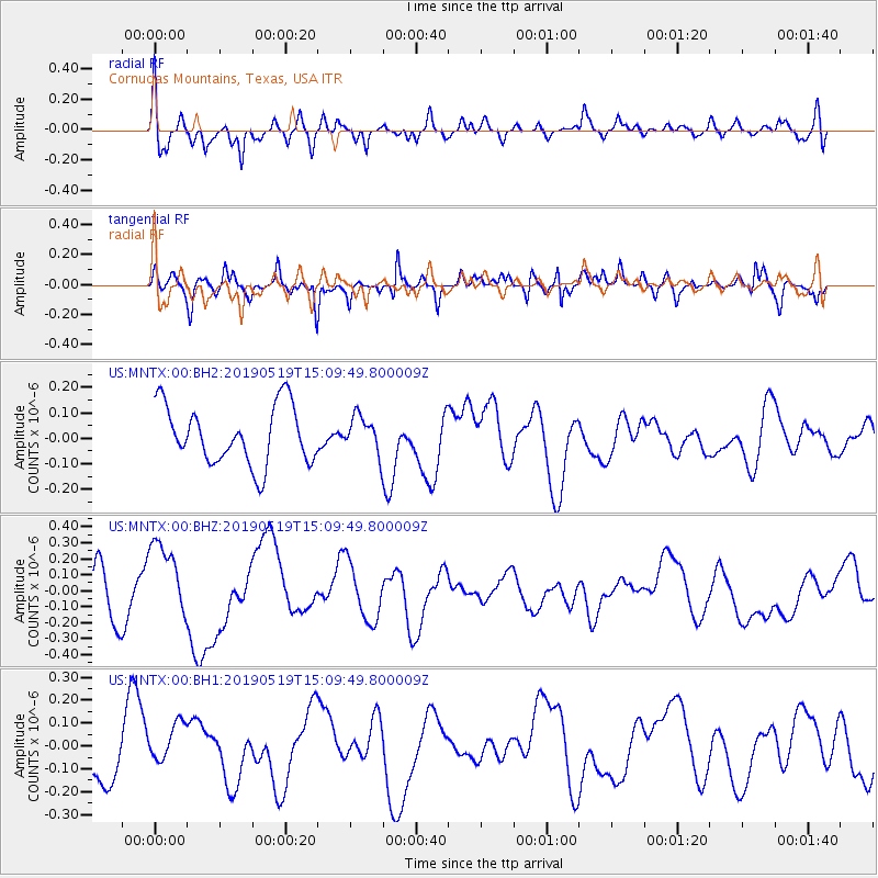
MNTX Cornudas Mountains, Texas, USA - Earthquake Result Viewer
*The percent match for this event was below the threshold and hence no stack was calculated.
| Earthquake location: |
Southeast Of Loyalty Islands |
| Earthquake latitude/longitude: |
-21.6/169.5 |
| Earthquake time(UTC): |
2019/05/19 (139) 14:56:50 GMT |
| Earthquake Depth: |
20 km |
| Earthquake Magnitude: |
6.3 mww |
| Earthquake Catalog/Contributor: |
NEIC PDE/us |
|
| Network: |
US United States National Seismic Network |
| Station: |
MNTX Cornudas Mountains, Texas, USA |
| Lat/Lon: |
31.70 N/105.38 W |
| Elevation: |
404 m |
|
| Distance: |
97.1 deg |
| Az: |
58.869 deg |
| Baz: |
249.146 deg |
| Ray Param: |
$rayparam |
*The percent match for this event was below the threshold and hence was not used in the summary stack. |
|
| Radial Match: |
61.332848 % |
| Radial Bump: |
400 |
| Transverse Match: |
66.48038 % |
| Transverse Bump: |
400 |
| SOD ConfigId: |
18369291 |
| Insert Time: |
2019-06-02 15:02:30.559 +0000 |
| GWidth: |
2.5 |
| Max Bumps: |
400 |
| Tol: |
0.001 |
|
Signal To Noise
| Channel | StoN | STA | LTA |
| US:MNTX:00:BHZ:20190519T15:09:49.800009Z | 1.6952668 | 2.3406164E-7 | 1.3806773E-7 |
| US:MNTX:00:BH1:20190519T15:09:49.800009Z | 1.6886714 | 1.1359925E-7 | 6.727138E-8 |
| US:MNTX:00:BH2:20190519T15:09:49.800009Z | 0.63258433 | 7.222676E-8 | 1.1417728E-7 |
| Arrivals |
| Ps | |
| PpPs | |
| PsPs/PpSs | |


