You are here: Home > Network List > US - United States National Seismic Network Stations List
> Station MSO Missoula, Montana, USA > Earthquake Result Viewer
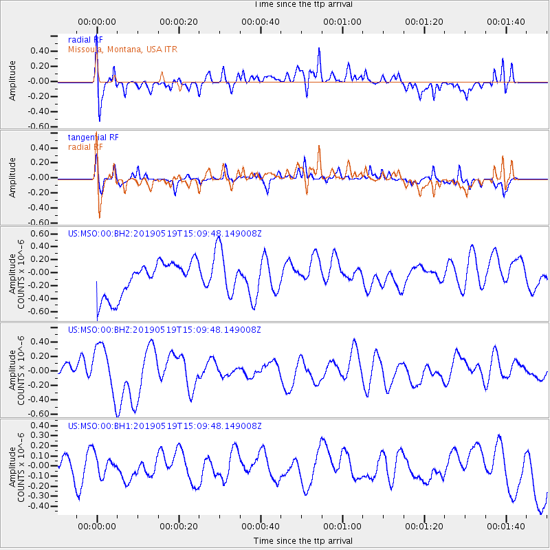
MSO Missoula, Montana, USA - Earthquake Result Viewer
*The percent match for this event was below the threshold and hence no stack was calculated.
| Earthquake location: |
Southeast Of Loyalty Islands |
| Earthquake latitude/longitude: |
-21.6/169.5 |
| Earthquake time(UTC): |
2019/05/19 (139) 14:56:50 GMT |
| Earthquake Depth: |
20 km |
| Earthquake Magnitude: |
6.3 mww |
| Earthquake Catalog/Contributor: |
NEIC PDE/us |
|
| Network: |
US United States National Seismic Network |
| Station: |
MSO Missoula, Montana, USA |
| Lat/Lon: |
46.83 N/113.94 W |
| Elevation: |
1264 m |
|
| Distance: |
96.8 deg |
| Az: |
42.268 deg |
| Baz: |
245.723 deg |
| Ray Param: |
$rayparam |
*The percent match for this event was below the threshold and hence was not used in the summary stack. |
|
| Radial Match: |
51.87064 % |
| Radial Bump: |
400 |
| Transverse Match: |
64.538086 % |
| Transverse Bump: |
366 |
| SOD ConfigId: |
18369291 |
| Insert Time: |
2019-06-02 15:02:30.597 +0000 |
| GWidth: |
2.5 |
| Max Bumps: |
400 |
| Tol: |
0.001 |
|
Signal To Noise
| Channel | StoN | STA | LTA |
| US:MSO:00:BHZ:20190519T15:09:48.149008Z | 3.3656461 | 3.4394142E-7 | 1.021918E-7 |
| US:MSO:00:BH1:20190519T15:09:48.149008Z | 0.9691779 | 9.3719024E-8 | 9.669951E-8 |
| US:MSO:00:BH2:20190519T15:09:48.149008Z | 1.3690375 | 3.616749E-7 | 2.641819E-7 |
| Arrivals |
| Ps | |
| PpPs | |
| PsPs/PpSs | |


