You are here: Home > Network List > TA - USArray Transportable Network (new EarthScope stations) Stations List
> Station N21A Black Mountain, Craig, CO, USA > Earthquake Result Viewer
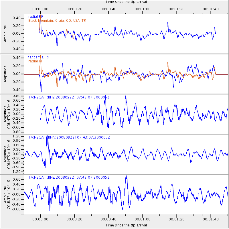
N21A Black Mountain, Craig, CO, USA - Earthquake Result Viewer
*The percent match for this event was below the threshold and hence no stack was calculated.
| Earthquake location: |
Hokkaido, Japan Region |
| Earthquake latitude/longitude: |
41.6/140.4 |
| Earthquake time(UTC): |
2008/09/22 (266) 07:31:59 GMT |
| Earthquake Depth: |
149 km |
| Earthquake Magnitude: |
5.7 MW, 5.3 MB, 5.6 MW |
| Earthquake Catalog/Contributor: |
WHDF/NEIC |
|
| Network: |
TA USArray Transportable Network (new EarthScope stations) |
| Station: |
N21A Black Mountain, Craig, CO, USA |
| Lat/Lon: |
40.76 N/107.52 W |
| Elevation: |
2235 m |
|
| Distance: |
77.5 deg |
| Az: |
46.155 deg |
| Baz: |
314.575 deg |
| Ray Param: |
$rayparam |
*The percent match for this event was below the threshold and hence was not used in the summary stack. |
|
| Radial Match: |
52.70335 % |
| Radial Bump: |
400 |
| Transverse Match: |
46.87432 % |
| Transverse Bump: |
400 |
| SOD ConfigId: |
2560 |
| Insert Time: |
2010-03-06 22:46:13.767 +0000 |
| GWidth: |
2.5 |
| Max Bumps: |
400 |
| Tol: |
0.001 |
|
Signal To Noise
| Channel | StoN | STA | LTA |
| TA:N21A: :BHN:20080922T07:43:07.300005Z | 3.5071166 | 5.564572E-7 | 1.5866516E-7 |
| TA:N21A: :BHE:20080922T07:43:07.300005Z | 1.5104251 | 2.3114355E-7 | 1.530321E-7 |
| TA:N21A: :BHZ:20080922T07:43:07.300005Z | 0.9130868 | 2.0003328E-7 | 2.190737E-7 |
| Arrivals |
| Ps | |
| PpPs | |
| PsPs/PpSs | |


