You are here: Home > Network List > NE - New England Seismic Network Stations List
> Station EMMW Machias, ME, USA > Earthquake Result Viewer
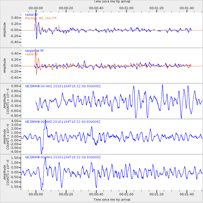
EMMW Machias, ME, USA - Earthquake Result Viewer
*The percent match for this event was below the threshold and hence no stack was calculated.
| Earthquake location: |
Chile-Argentina Border Region |
| Earthquake latitude/longitude: |
-35.1/-71.0 |
| Earthquake time(UTC): |
2016/11/04 (309) 16:20:43 GMT |
| Earthquake Depth: |
91 km |
| Earthquake Magnitude: |
6.4 MWP, 6.4 MWW |
| Earthquake Catalog/Contributor: |
NEIC PDE/NEIC COMCAT |
|
| Network: |
NE New England Seismic Network |
| Station: |
EMMW Machias, ME, USA |
| Lat/Lon: |
44.71 N/67.46 W |
| Elevation: |
35 m |
|
| Distance: |
79.5 deg |
| Az: |
2.566 deg |
| Baz: |
182.951 deg |
| Ray Param: |
$rayparam |
*The percent match for this event was below the threshold and hence was not used in the summary stack. |
|
| Radial Match: |
68.30253 % |
| Radial Bump: |
400 |
| Transverse Match: |
58.7559 % |
| Transverse Bump: |
400 |
| SOD ConfigId: |
1815711 |
| Insert Time: |
2016-11-18 16:25:58.416 +0000 |
| GWidth: |
2.5 |
| Max Bumps: |
400 |
| Tol: |
0.001 |
|
Signal To Noise
| Channel | StoN | STA | LTA |
| NE:EMMW:00:HHZ:20161104T16:32:09.609006Z | 4.4157567 | 1.8446559E-6 | 4.1774402E-7 |
| NE:EMMW:00:HH1:20161104T16:32:09.609006Z | 2.316172 | 8.188565E-7 | 3.5353875E-7 |
| NE:EMMW:00:HH2:20161104T16:32:09.609006Z | 0.8216214 | 1.8512128E-7 | 2.2531214E-7 |
| Arrivals |
| Ps | |
| PpPs | |
| PsPs/PpSs | |


