You are here: Home > Network List > TS - TERRAscope (Southern California Seismic Network) Stations List
> Station GLA Glamis, California, USA > Earthquake Result Viewer
GLA Glamis, California, USA - Earthquake Result Viewer
*The percent match for this event was below the threshold and hence no stack was calculated.
| Earthquake location: |
South Of Fiji Islands |
| Earthquake latitude/longitude: |
-24.6/-177.3 |
| Earthquake time(UTC): |
1995/06/23 (174) 16:10:56 GMT |
| Earthquake Depth: |
108 km |
| Earthquake Magnitude: |
5.8 UNKNOWN, 5.4 MB |
| Earthquake Catalog/Contributor: |
WHDF/NEIC |
|
| Network: |
TS TERRAscope (Southern California Seismic Network) |
| Station: |
GLA Glamis, California, USA |
| Lat/Lon: |
33.05 N/114.83 W |
| Elevation: |
627 m |
|
| Distance: |
82.6 deg |
| Az: |
48.67 deg |
| Baz: |
234.494 deg |
| Ray Param: |
$rayparam |
*The percent match for this event was below the threshold and hence was not used in the summary stack. |
|
| Radial Match: |
54.443695 % |
| Radial Bump: |
400 |
| Transverse Match: |
62.204502 % |
| Transverse Bump: |
400 |
| SOD ConfigId: |
4480 |
| Insert Time: |
2010-02-26 14:13:51.503 +0000 |
| GWidth: |
2.5 |
| Max Bumps: |
400 |
| Tol: |
0.001 |
|
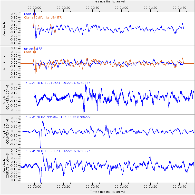
Signal To Noise
| Channel | StoN | STA | LTA |
| TS:GLA: :BHN:19950623T16:22:36.878027Z | 7.459135 | 3.5088706E-7 | 4.7041254E-8 |
| TS:GLA: :BHE:19950623T16:22:36.878027Z | 3.5605803 | 1.6083946E-7 | 4.517226E-8 |
| TS:GLA: :BHZ:19950623T16:22:36.878027Z | 2.1022842 | 1.2490362E-7 | 5.9413292E-8 |
| Arrivals |
| Ps | |
| PpPs | |
| PsPs/PpSs | |


