
W14A Seligman, AZ, USA - Earthquake Result Viewer
| ||||||||||||||||||
| ||||||||||||||||||
| ||||||||||||||||||
|
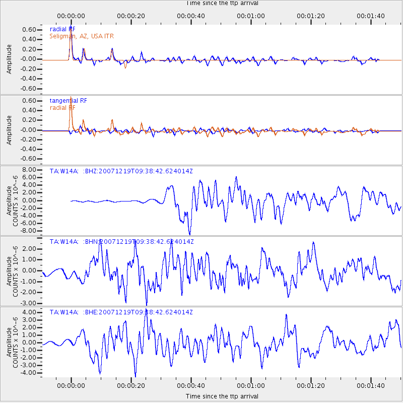
Signal To Noise
| Channel | StoN | STA | LTA |
| TA:W14A: :BHN:20071219T09:38:42.624014Z | 2.367821 | 6.812582E-7 | 2.8771527E-7 |
| TA:W14A: :BHE:20071219T09:38:42.624014Z | 7.013636 | 9.802628E-7 | 1.3976529E-7 |
| TA:W14A: :BHZ:20071219T09:38:42.624014Z | 15.959177 | 2.4541275E-6 | 1.5377532E-7 |
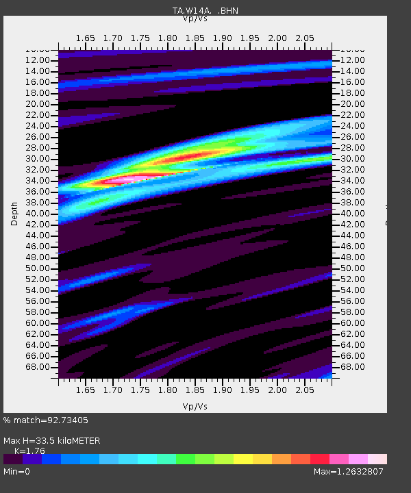
| Arrivals | |
| Ps | 4.3 SECOND |
| PpPs | 14 SECOND |
| PsPs/PpSs | 18 SECOND |

