
W14A Seligman, AZ, USA - Earthquake Result Viewer
| ||||||||||||||||||
| ||||||||||||||||||
| ||||||||||||||||||
|
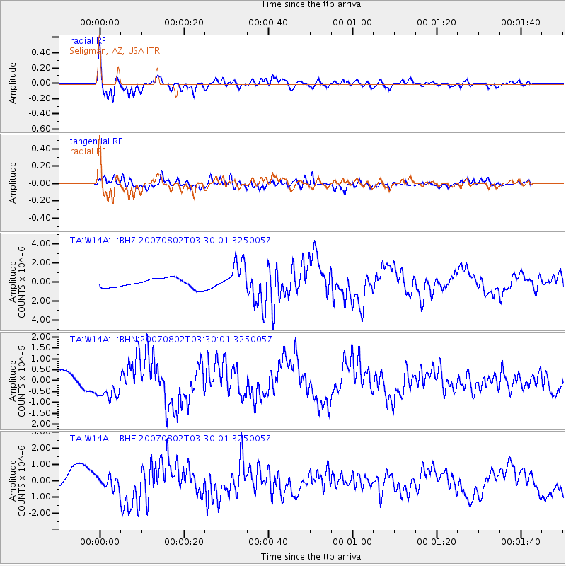
Signal To Noise
| Channel | StoN | STA | LTA |
| TA:W14A: :BHN:20070802T03:30:01.325005Z | 2.21396 | 6.7758435E-7 | 3.0605088E-7 |
| TA:W14A: :BHE:20070802T03:30:01.325005Z | 0.7221729 | 3.7423803E-7 | 5.182111E-7 |
| TA:W14A: :BHZ:20070802T03:30:01.325005Z | 3.3891363 | 1.6503187E-6 | 4.8694375E-7 |
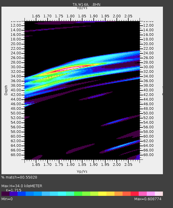
| Arrivals | |
| Ps | 4.1 SECOND |
| PpPs | 14 SECOND |
| PsPs/PpSs | 18 SECOND |

