
W14A Seligman, AZ, USA - Earthquake Result Viewer
| ||||||||||||||||||
| ||||||||||||||||||
| ||||||||||||||||||
|
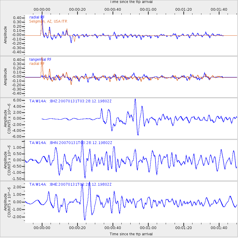
Signal To Noise
| Channel | StoN | STA | LTA |
| TA:W14A: :BHN:20070131T03:28:12.19802Z | 1.5909156 | 2.330668E-7 | 1.4649854E-7 |
| TA:W14A: :BHE:20070131T03:28:12.19802Z | 4.6632047 | 5.769983E-7 | 1.2373428E-7 |
| TA:W14A: :BHZ:20070131T03:28:12.19802Z | 8.423997 | 1.1738244E-6 | 1.3934293E-7 |
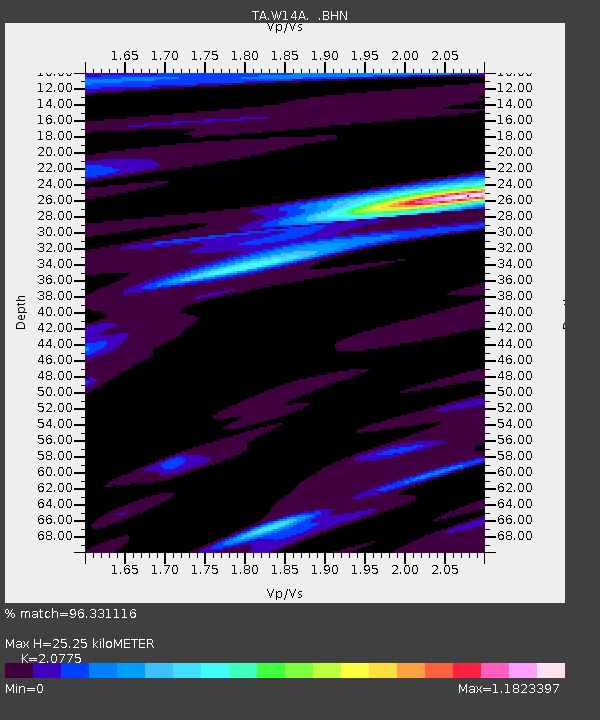
| Arrivals | |
| Ps | 4.4 SECOND |
| PpPs | 12 SECOND |
| PsPs/PpSs | 17 SECOND |

