You are here: Home > Network List > TS - TERRAscope (Southern California Seismic Network) Stations List
> Station GLA Glamis, California, USA > Earthquake Result Viewer
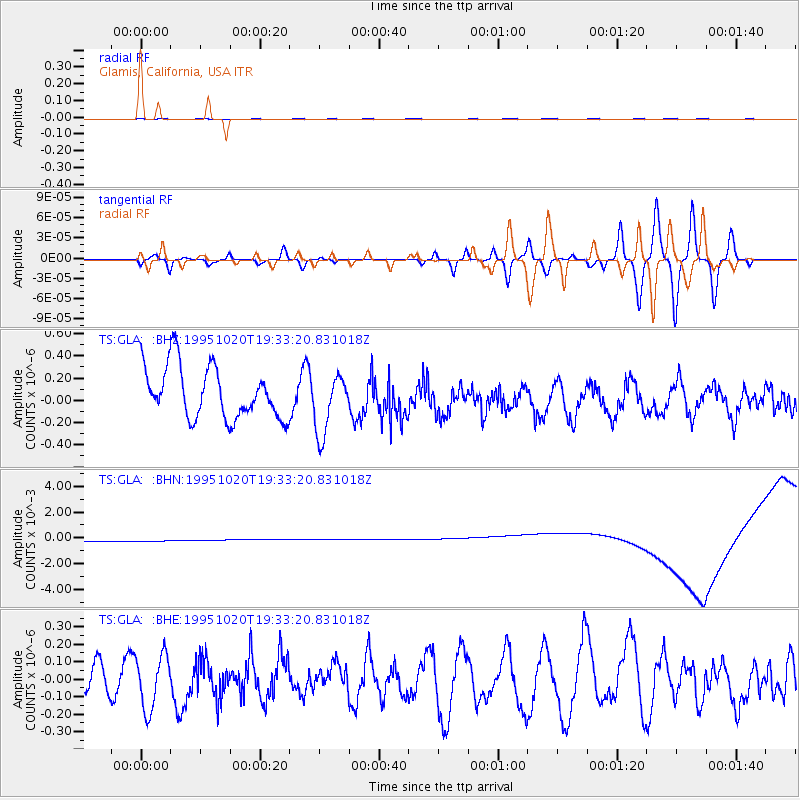
GLA Glamis, California, USA - Earthquake Result Viewer
*The percent match for this event was below the threshold and hence no stack was calculated.
| Earthquake location: |
Mariana Islands |
| Earthquake latitude/longitude: |
18.8/145.4 |
| Earthquake time(UTC): |
1995/10/20 (293) 19:21:28 GMT |
| Earthquake Depth: |
225 km |
| Earthquake Magnitude: |
5.5 UNKNOWN, 5.3 MB |
| Earthquake Catalog/Contributor: |
WHDF/NEIC |
|
| Network: |
TS TERRAscope (Southern California Seismic Network) |
| Station: |
GLA Glamis, California, USA |
| Lat/Lon: |
33.05 N/114.83 W |
| Elevation: |
627 m |
|
| Distance: |
87.8 deg |
| Az: |
55.919 deg |
| Baz: |
290.875 deg |
| Ray Param: |
$rayparam |
*The percent match for this event was below the threshold and hence was not used in the summary stack. |
|
| Radial Match: |
47.937008 % |
| Radial Bump: |
400 |
| Transverse Match: |
44.575985 % |
| Transverse Bump: |
400 |
| SOD ConfigId: |
4480 |
| Insert Time: |
2010-02-26 14:14:09.126 +0000 |
| GWidth: |
2.5 |
| Max Bumps: |
400 |
| Tol: |
0.001 |
|
Signal To Noise
| Channel | StoN | STA | LTA |
| TS:GLA: :BHN:19951020T19:33:20.831018Z | 0.9166801 | 6.1454397E-4 | 6.704018E-4 |
| TS:GLA: :BHE:19951020T19:33:20.831018Z | 1.87916 | 1.551466E-7 | 8.256167E-8 |
| TS:GLA: :BHZ:19951020T19:33:20.831018Z | 1.1637564 | 2.7154306E-7 | 2.3333324E-7 |
| Arrivals |
| Ps | |
| PpPs | |
| PsPs/PpSs | |


