B05A Bryant, WA, USA - Earthquake Result Viewer
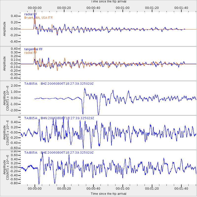
Earthquake location: Bonin Islands, Japan Region
Earthquake latitude/longitude: 26.1/144.0
Earthquake time(UTC): 2006/08/06 (218) 18:16:40 GMT
Earthquake Depth: 23 km
Earthquake Magnitude: 6.0 MB, 5.6 MS, 5.8 MW, 5.8 MW
Earthquake Catalog/Contributor: WHDF/NEIC
Network: TA USArray Transportable Network (new EarthScope stations)
Station: B05A Bryant, WA, USA
Lat/Lon: 48.26 N/122.10 W
Elevation: 154 m
Distance: 73.4 deg
Az: 44.065 deg
Baz: 290.649 deg
Ray Param: 0.05297394
Estimated Moho Depth: 52.75 km
Estimated Crust Vp/Vs: 1.60
Assumed Crust Vp: 6.566 km/s
Estimated Crust Vs: 4.104 km/s
Estimated Crust Poisson's Ratio: 0.18
Radial Match: 87.98273 %
Radial Bump: 400
Transverse Match: 82.28626 %
Transverse Bump: 400
SOD ConfigId: 2665
Insert Time: 2010-03-06 22:55:57.410 +0000
GWidth: 2.5
Max Bumps: 400
Tol: 0.001

Signal To Noise

ChannelStoNSTALTA
TA:B05A: :BHN:20060806T18:27:39.325029Z2.77329282.0102857E-77.2487325E-8
TA:B05A: :BHE:20060806T18:27:39.325029Z5.71450333.371411E-75.8997443E-8
TA:B05A: :BHZ:20060806T18:27:39.325029Z17.5485271.0553274E-66.0137666E-8
Arrivals
Ps5.0 SECOND
PpPs20 SECOND
PsPs/PpSs25 SECOND