B05A Bryant, WA, USA - Earthquake Result Viewer
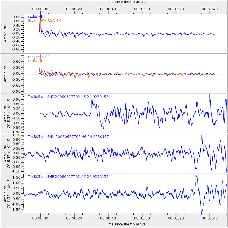
Earthquake location: Rat Islands, Aleutian Islands
Earthquake latitude/longitude: 52.2/176.2
Earthquake time(UTC): 2006/06/27 (178) 02:39:35 GMT
Earthquake Depth: 34 km
Earthquake Magnitude: 5.6 MB, 6.0 MS, 6.2 MW, 6.2 MW
Earthquake Catalog/Contributor: WHDF/NEIC
Network: TA USArray Transportable Network (new EarthScope stations)
Station: B05A Bryant, WA, USA
Lat/Lon: 48.26 N/122.10 W
Elevation: 154 m
Distance: 38.6 deg
Az: 70.503 deg
Baz: 299.75 deg
Ray Param: 0.07538787
Estimated Moho Depth: 56.75 km
Estimated Crust Vp/Vs: 1.73
Assumed Crust Vp: 6.566 km/s
Estimated Crust Vs: 3.79 km/s
Estimated Crust Poisson's Ratio: 0.25
Radial Match: 86.8526 %
Radial Bump: 350
Transverse Match: 70.7359 %
Transverse Bump: 400
SOD ConfigId: 2665
Insert Time: 2010-03-06 22:56:06.121 +0000
GWidth: 2.5
Max Bumps: 400
Tol: 0.001

Signal To Noise

ChannelStoNSTALTA
TA:B05A: :BHN:20060627T02:46:24.923015Z2.65217192.1928682E-78.268198E-8
TA:B05A: :BHE:20060627T02:46:24.923015Z2.07558662.3788736E-71.14612114E-7
TA:B05A: :BHZ:20060627T02:46:24.923015Z5.7860665.1201795E-78.849155E-8
Arrivals
Ps6.8 SECOND
PpPs22 SECOND
PsPs/PpSs29 SECOND