
Y13A Salome, AZ, USA - Earthquake Result Viewer
| ||||||||||||||||||
| ||||||||||||||||||
| ||||||||||||||||||
|
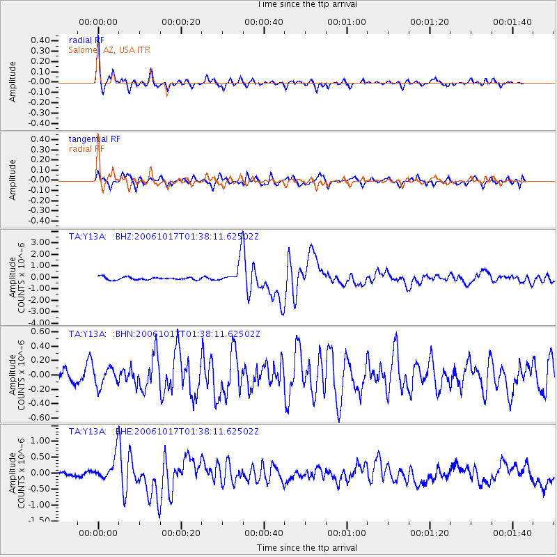
Signal To Noise
| Channel | StoN | STA | LTA |
| TA:Y13A: :BHN:20061017T01:38:11.62502Z | 1.2108597 | 1.2428849E-7 | 1.0264484E-7 |
| TA:Y13A: :BHE:20061017T01:38:11.62502Z | 5.7940164 | 4.3772775E-7 | 7.5548236E-8 |
| TA:Y13A: :BHZ:20061017T01:38:11.62502Z | 10.668168 | 1.233046E-6 | 1.1558179E-7 |
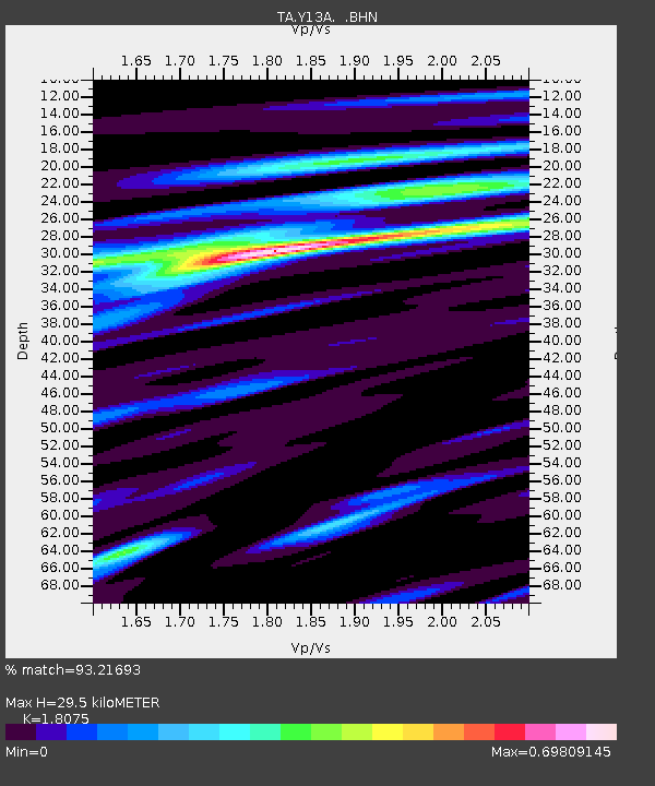
| Arrivals | |
| Ps | 3.9 SECOND |
| PpPs | 13 SECOND |
| PsPs/PpSs | 17 SECOND |

