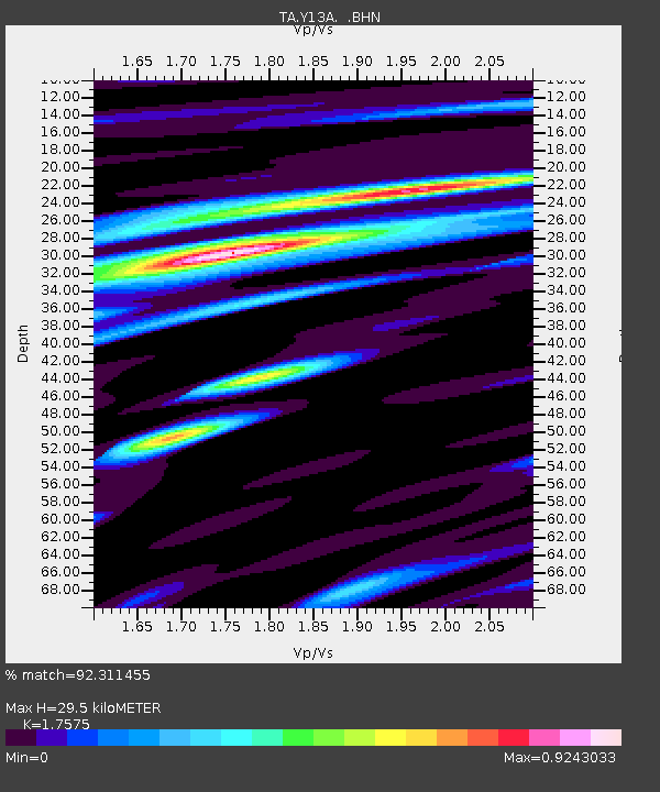
Y13A Salome, AZ, USA - Earthquake Result Viewer
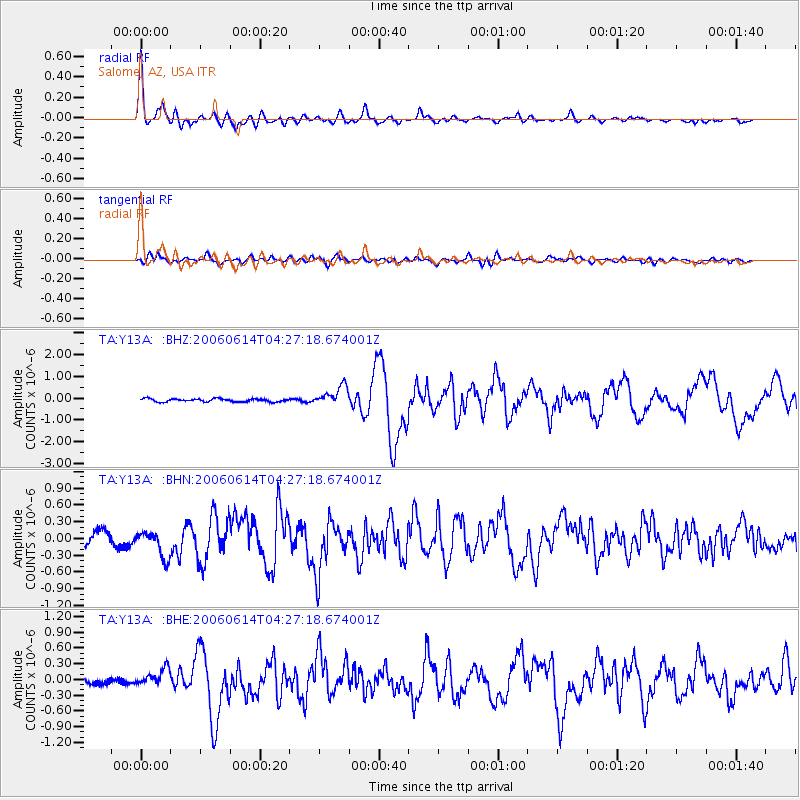
Earthquake location: Rat Islands, Aleutian Islands
Earthquake latitude/longitude: 51.8/177.1
Earthquake time(UTC): 2006/06/14 (165) 04:18:42 GMT
Earthquake Depth: 14 km
Earthquake Magnitude: 5.9 MB, 6.4 MS, 6.4 MW, 6.4 MW
Earthquake Catalog/Contributor: WHDF/NEIC
Network: TA USArray Transportable Network (new EarthScope stations)
Station: Y13A Salome, AZ, USA
Lat/Lon: 33.81 N/113.83 W
Elevation: 357 m
Distance: 51.8 deg
Az: 81.836 deg
Baz: 312.347 deg
Ray Param: 0.06717565
Estimated Moho Depth: 29.5 km
Estimated Crust Vp/Vs: 1.76
Assumed Crust Vp: 6.264 km/s
Estimated Crust Vs: 3.564 km/s
Estimated Crust Poisson's Ratio: 0.26
Radial Match: 92.311455 %
Radial Bump: 400
Transverse Match: 65.96612 %
Transverse Bump: 400
SOD ConfigId: 5745
Insert Time: 2010-03-06 22:59:39.972 +0000
GWidth: 2.5
Max Bumps: 400
Tol: 0.001

Signal To Noise

ChannelStoNSTALTA
TA:Y13A: :BHN:20060614T04:27:18.674001Z2.03815562.3779516E-71.1667175E-7
TA:Y13A: :BHE:20060614T04:27:18.674001Z3.7336731.6643715E-74.457732E-8
TA:Y13A: :BHZ:20060614T04:27:18.674001Z6.3787664.4557913E-76.98535E-8
Arrivals
Ps3.8 SECOND
PpPs12 SECOND
PsPs/PpSs16 SECOND