L17A Cokeville, WY, USA - Earthquake Result Viewer
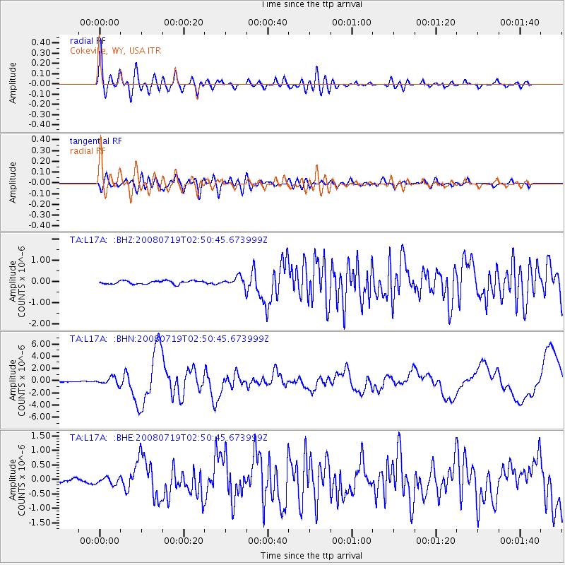
Earthquake location: Off East Coast Of Honshu, Japan
Earthquake latitude/longitude: 37.6/142.2
Earthquake time(UTC): 2008/07/19 (201) 02:39:28 GMT
Earthquake Depth: 22 km
Earthquake Magnitude: 6.2 MB, 7.0 MS, 7.0 MW, 6.9 MW
Earthquake Catalog/Contributor: WHDF/NEIC
Network: TA USArray Transportable Network (new EarthScope stations)
Station: L17A Cokeville, WY, USA
Lat/Lon: 42.10 N/110.87 W
Elevation: 1996 m
Distance: 76.5 deg
Az: 47.074 deg
Baz: 308.558 deg
Ray Param: 0.0509238
Estimated Moho Depth: 43.25 km
Estimated Crust Vp/Vs: 1.71
Assumed Crust Vp: 6.207 km/s
Estimated Crust Vs: 3.63 km/s
Estimated Crust Poisson's Ratio: 0.24
Radial Match: 90.90316 %
Radial Bump: 400
Transverse Match: 77.09189 %
Transverse Bump: 400
SOD ConfigId: 2504
Insert Time: 2010-03-06 23:00:05.279 +0000
GWidth: 2.5
Max Bumps: 400
Tol: 0.001

Signal To Noise

ChannelStoNSTALTA
TA:L17A: :BHN:20080719T02:50:45.673999Z7.2640635.909946E-78.1358685E-8
TA:L17A: :BHE:20080719T02:50:45.673999Z1.32021161.14966056E-78.708153E-8
TA:L17A: :BHZ:20080719T02:50:45.673999Z3.02863552.32982E-77.692639E-8
Arrivals
Ps5.1 SECOND
PpPs18 SECOND
PsPs/PpSs23 SECOND