
L17A Cokeville, WY, USA - Earthquake Result Viewer
| ||||||||||||||||||
| ||||||||||||||||||
| ||||||||||||||||||
|
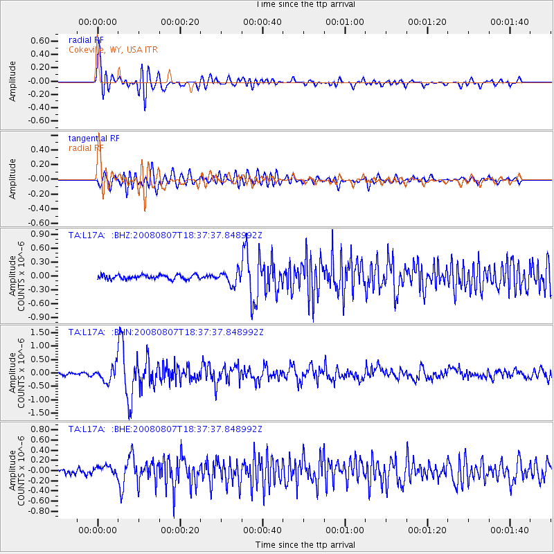
Signal To Noise
| Channel | StoN | STA | LTA |
| TA:L17A: :BHN:20080807T18:37:37.848992Z | 5.7172647 | 2.9364853E-7 | 5.136172E-8 |
| TA:L17A: :BHE:20080807T18:37:37.848992Z | 1.8413569 | 9.712827E-8 | 5.2748206E-8 |
| TA:L17A: :BHZ:20080807T18:37:37.848992Z | 3.1222842 | 1.4353319E-7 | 4.5970573E-8 |
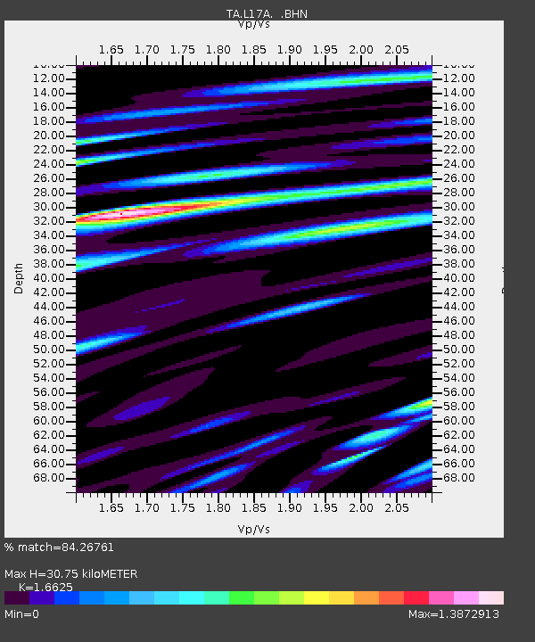
| Arrivals | |
| Ps | 3.5 SECOND |
| PpPs | 12 SECOND |
| PsPs/PpSs | 16 SECOND |

