L17A Cokeville, WY, USA - Earthquake Result Viewer
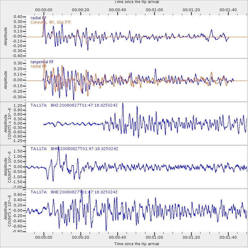
Earthquake location: Lake Baykal Region, Russia
Earthquake latitude/longitude: 51.6/104.2
Earthquake time(UTC): 2008/08/27 (240) 01:35:32 GMT
Earthquake Depth: 16 km
Earthquake Magnitude: 5.8 MB, 6.2 MS, 6.2 MW, 6.2 MW
Earthquake Catalog/Contributor: WHDF/NEIC
Network: TA USArray Transportable Network (new EarthScope stations)
Station: L17A Cokeville, WY, USA
Lat/Lon: 42.10 N/110.87 W
Elevation: 1996 m
Distance: 81.8 deg
Az: 25.567 deg
Baz: 338.799 deg
Ray Param: 0.047300693
Estimated Moho Depth: 43.25 km
Estimated Crust Vp/Vs: 1.75
Assumed Crust Vp: 6.207 km/s
Estimated Crust Vs: 3.547 km/s
Estimated Crust Poisson's Ratio: 0.26
Radial Match: 85.6994 %
Radial Bump: 400
Transverse Match: 83.80403 %
Transverse Bump: 400
SOD ConfigId: 2504
Insert Time: 2010-03-06 23:00:14.059 +0000
GWidth: 2.5
Max Bumps: 400
Tol: 0.001

Signal To Noise

ChannelStoNSTALTA
TA:L17A: :BHN:20080827T01:47:18.925024Z7.48765.0432993E-76.735535E-8
TA:L17A: :BHE:20080827T01:47:18.925024Z2.55316881.3890032E-75.440311E-8
TA:L17A: :BHZ:20080827T01:47:18.925024Z1.99713641.3022007E-76.5203395E-8
Arrivals
Ps5.4 SECOND
PpPs19 SECOND
PsPs/PpSs24 SECOND