
L17A Cokeville, WY, USA - Earthquake Result Viewer
| ||||||||||||||||||
| ||||||||||||||||||
| ||||||||||||||||||
|
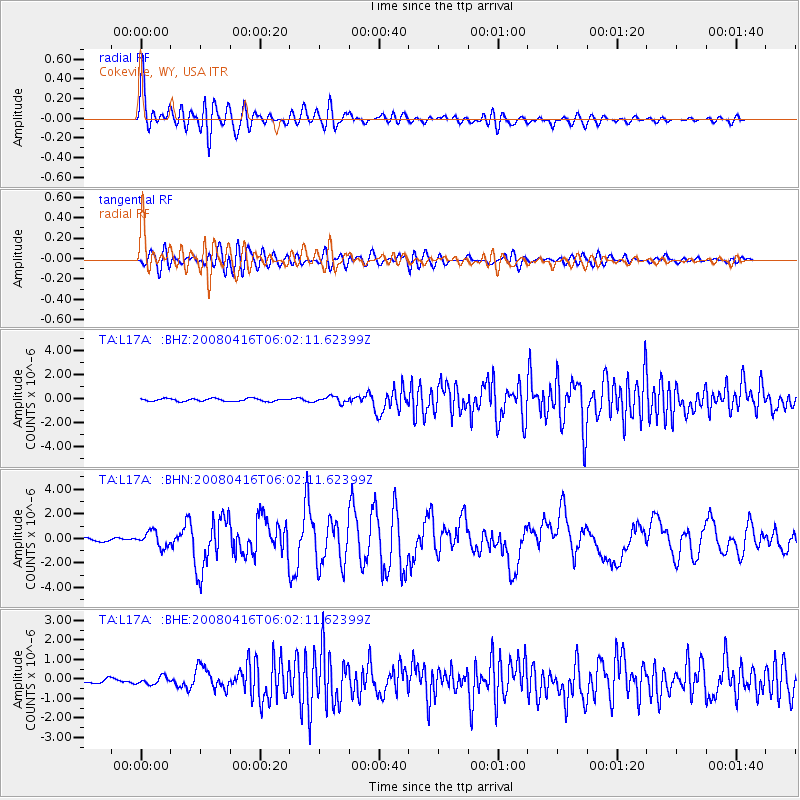
Signal To Noise
| Channel | StoN | STA | LTA |
| TA:L17A: :BHN:20080416T06:02:11.62399Z | 7.1255655 | 6.2162746E-7 | 8.723904E-8 |
| TA:L17A: :BHE:20080416T06:02:11.62399Z | 1.7584875 | 1.9363048E-7 | 1.10111955E-7 |
| TA:L17A: :BHZ:20080416T06:02:11.62399Z | 2.2738044 | 2.627065E-7 | 1.15536096E-7 |
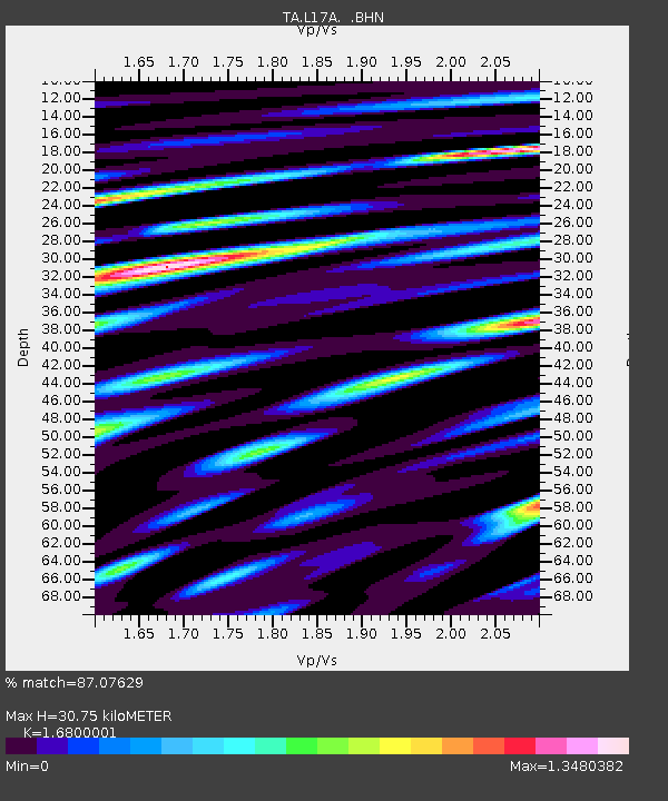
| Arrivals | |
| Ps | 3.6 SECOND |
| PpPs | 12 SECOND |
| PsPs/PpSs | 16 SECOND |

