You are here: Home > Network List > US - United States National Seismic Network Stations List
> Station DGMT Dagmar, Montana, USA > Earthquake Result Viewer
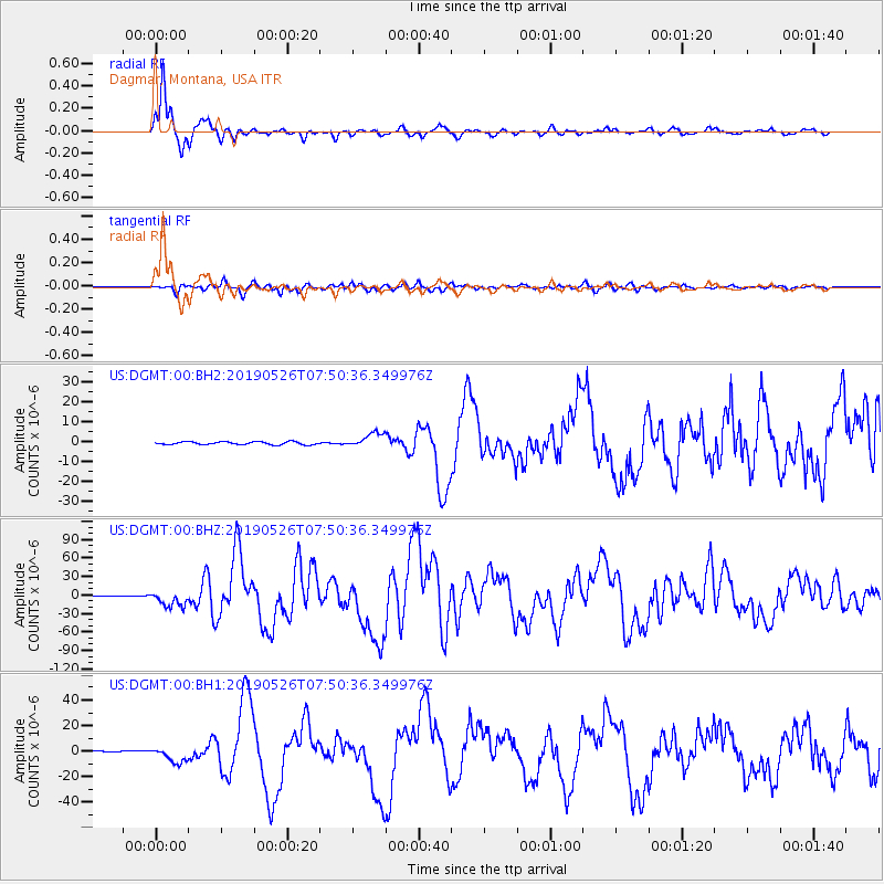
DGMT Dagmar, Montana, USA - Earthquake Result Viewer
*The percent match for this event was below the threshold and hence no stack was calculated.
| Earthquake location: |
Northern Peru |
| Earthquake latitude/longitude: |
-5.9/-75.3 |
| Earthquake time(UTC): |
2019/05/26 (146) 07:41:13 GMT |
| Earthquake Depth: |
105 km |
| Earthquake Magnitude: |
7.5 Mi |
| Earthquake Catalog/Contributor: |
NEIC PDE/at |
|
| Network: |
US United States National Seismic Network |
| Station: |
DGMT Dagmar, Montana, USA |
| Lat/Lon: |
48.47 N/104.20 W |
| Elevation: |
0.0 m |
|
| Distance: |
59.8 deg |
| Az: |
338.15 deg |
| Baz: |
146.199 deg |
| Ray Param: |
$rayparam |
*The percent match for this event was below the threshold and hence was not used in the summary stack. |
|
| Radial Match: |
97.37312 % |
| Radial Bump: |
322 |
| Transverse Match: |
87.89669 % |
| Transverse Bump: |
400 |
| SOD ConfigId: |
18369291 |
| Insert Time: |
2019-06-09 07:53:59.299 +0000 |
| GWidth: |
2.5 |
| Max Bumps: |
400 |
| Tol: |
0.001 |
|
Signal To Noise
| Channel | StoN | STA | LTA |
| US:DGMT:00:BHZ:20190526T07:50:36.349976Z | 27.762611 | 1.2730685E-5 | 4.5855504E-7 |
| US:DGMT:00:BH1:20190526T07:50:36.349976Z | 17.59866 | 6.181828E-6 | 3.5126698E-7 |
| US:DGMT:00:BH2:20190526T07:50:36.349976Z | 5.1976376 | 3.659072E-6 | 7.039876E-7 |
| Arrivals |
| Ps | |
| PpPs | |
| PsPs/PpSs | |


