You are here: Home > Network List > TA - USArray Transportable Network (new EarthScope stations) Stations List
> Station L17A Cokeville, WY, USA > Earthquake Result Viewer
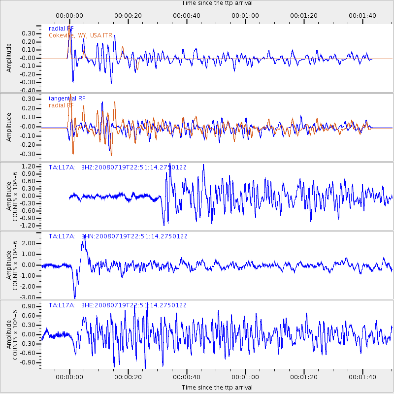
L17A Cokeville, WY, USA - Earthquake Result Viewer
*The percent match for this event was below the threshold and hence no stack was calculated.
| Earthquake location: |
Fiji Islands Region |
| Earthquake latitude/longitude: |
-17.3/-177.3 |
| Earthquake time(UTC): |
2008/07/19 (201) 22:39:52 GMT |
| Earthquake Depth: |
391 km |
| Earthquake Magnitude: |
5.9 MB, 6.4 MW, 6.4 MW |
| Earthquake Catalog/Contributor: |
WHDF/NEIC |
|
| Network: |
TA USArray Transportable Network (new EarthScope stations) |
| Station: |
L17A Cokeville, WY, USA |
| Lat/Lon: |
42.10 N/110.87 W |
| Elevation: |
1996 m |
|
| Distance: |
85.0 deg |
| Az: |
43.215 deg |
| Baz: |
241.497 deg |
| Ray Param: |
$rayparam |
*The percent match for this event was below the threshold and hence was not used in the summary stack. |
|
| Radial Match: |
79.247734 % |
| Radial Bump: |
400 |
| Transverse Match: |
63.51242 % |
| Transverse Bump: |
400 |
| SOD ConfigId: |
2504 |
| Insert Time: |
2010-03-06 23:01:12.876 +0000 |
| GWidth: |
2.5 |
| Max Bumps: |
400 |
| Tol: |
0.001 |
|
Signal To Noise
| Channel | StoN | STA | LTA |
| TA:L17A: :BHN:20080719T22:51:14.275012Z | 18.770664 | 1.3843556E-6 | 7.375102E-8 |
| TA:L17A: :BHE:20080719T22:51:14.275012Z | 3.5507383 | 2.9054385E-7 | 8.1826315E-8 |
| TA:L17A: :BHZ:20080719T22:51:14.275012Z | 9.501486 | 6.3622025E-7 | 6.696008E-8 |
| Arrivals |
| Ps | |
| PpPs | |
| PsPs/PpSs | |


