You are here: Home > Network List > PF - Volcanologic Network of Piton de Fournaise-OVPF Stations List
> Station HIM cratere Himiltrude > Earthquake Result Viewer
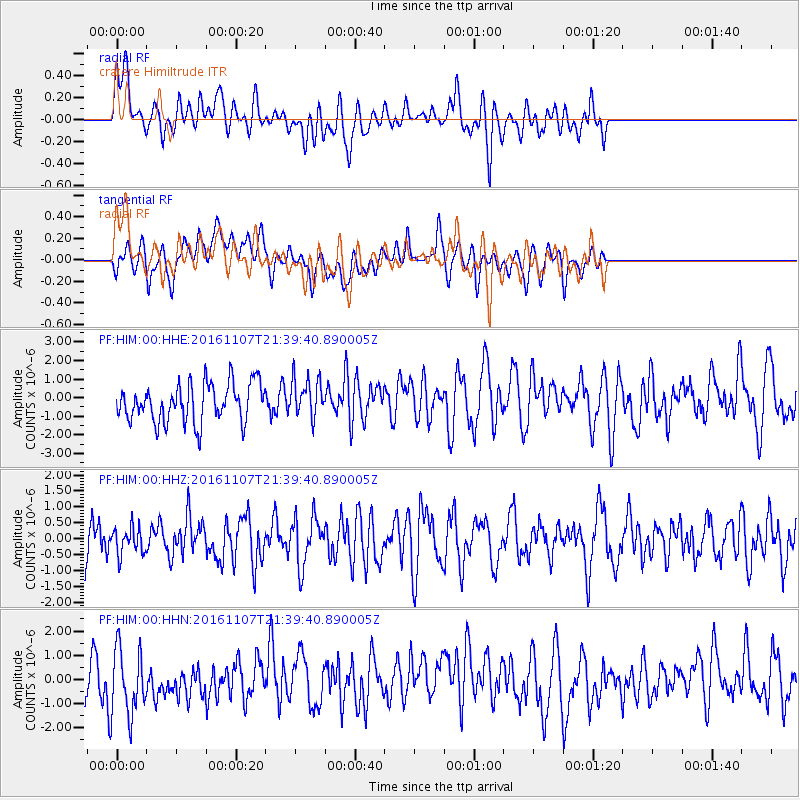
HIM cratere Himiltrude - Earthquake Result Viewer
*The percent match for this event was below the threshold and hence no stack was calculated.
| Earthquake location: |
Southwest Of Sumatra, Indonesia |
| Earthquake latitude/longitude: |
-8.1/104.8 |
| Earthquake time(UTC): |
2016/11/07 (312) 21:31:24 GMT |
| Earthquake Depth: |
10 km |
| Earthquake Magnitude: |
5.6 MWB |
| Earthquake Catalog/Contributor: |
NEIC PDE/NEIC COMCAT |
|
| Network: |
PF Volcanologic Network of Piton de Fournaise-OVPF |
| Station: |
HIM cratere Himiltrude |
| Lat/Lon: |
21.21 S/55.72 E |
| Elevation: |
1958 m |
|
| Distance: |
49.0 deg |
| Az: |
249.044 deg |
| Baz: |
82.255 deg |
| Ray Param: |
$rayparam |
*The percent match for this event was below the threshold and hence was not used in the summary stack. |
|
| Radial Match: |
48.172787 % |
| Radial Bump: |
400 |
| Transverse Match: |
45.76641 % |
| Transverse Bump: |
400 |
| SOD ConfigId: |
1858311 |
| Insert Time: |
2016-11-22 14:43:47.629 +0000 |
| GWidth: |
2.5 |
| Max Bumps: |
400 |
| Tol: |
0.001 |
|
Signal To Noise
| Channel | StoN | STA | LTA |
| PF:HIM:00:HHZ:20161107T21:39:40.890005Z | 0.527262 | 4.261017E-7 | 8.081404E-7 |
| PF:HIM:00:HHN:20161107T21:39:40.890005Z | 1.434381 | 1.4459032E-6 | 1.0080329E-6 |
| PF:HIM:00:HHE:20161107T21:39:40.890005Z | 1.0282315 | 1.0606989E-6 | 1.031576E-6 |
| Arrivals |
| Ps | |
| PpPs | |
| PsPs/PpSs | |


