You are here: Home > Network List > TA - USArray Transportable Network (new EarthScope stations) Stations List
> Station L17A Cokeville, WY, USA > Earthquake Result Viewer
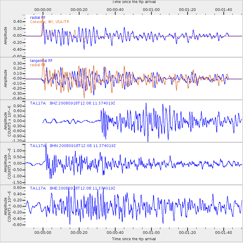
L17A Cokeville, WY, USA - Earthquake Result Viewer
*The percent match for this event was below the threshold and hence no stack was calculated.
| Earthquake location: |
Near East Coast Of Kamchatka |
| Earthquake latitude/longitude: |
51.9/158.4 |
| Earthquake time(UTC): |
2008/09/18 (262) 11:58:50 GMT |
| Earthquake Depth: |
67 km |
| Earthquake Magnitude: |
5.7 MB, 5.9 MW, 5.8 MW |
| Earthquake Catalog/Contributor: |
WHDF/NEIC |
|
| Network: |
TA USArray Transportable Network (new EarthScope stations) |
| Station: |
L17A Cokeville, WY, USA |
| Lat/Lon: |
42.10 N/110.87 W |
| Elevation: |
1996 m |
|
| Distance: |
58.8 deg |
| Az: |
60.488 deg |
| Baz: |
313.597 deg |
| Ray Param: |
$rayparam |
*The percent match for this event was below the threshold and hence was not used in the summary stack. |
|
| Radial Match: |
75.05102 % |
| Radial Bump: |
400 |
| Transverse Match: |
69.01702 % |
| Transverse Bump: |
400 |
| SOD ConfigId: |
2560 |
| Insert Time: |
2010-03-06 23:01:45.871 +0000 |
| GWidth: |
2.5 |
| Max Bumps: |
400 |
| Tol: |
0.001 |
|
Signal To Noise
| Channel | StoN | STA | LTA |
| TA:L17A: :BHN:20080918T12:08:11.374019Z | 7.6196485 | 5.5620734E-7 | 7.299646E-8 |
| TA:L17A: :BHE:20080918T12:08:11.374019Z | 1.5955608 | 1.6914575E-7 | 1.06010226E-7 |
| TA:L17A: :BHZ:20080918T12:08:11.374019Z | 5.580515 | 3.958422E-7 | 7.093291E-8 |
| Arrivals |
| Ps | |
| PpPs | |
| PsPs/PpSs | |


