You are here: Home > Network List > TA - USArray Transportable Network (new EarthScope stations) Stations List
> Station L17A Cokeville, WY, USA > Earthquake Result Viewer
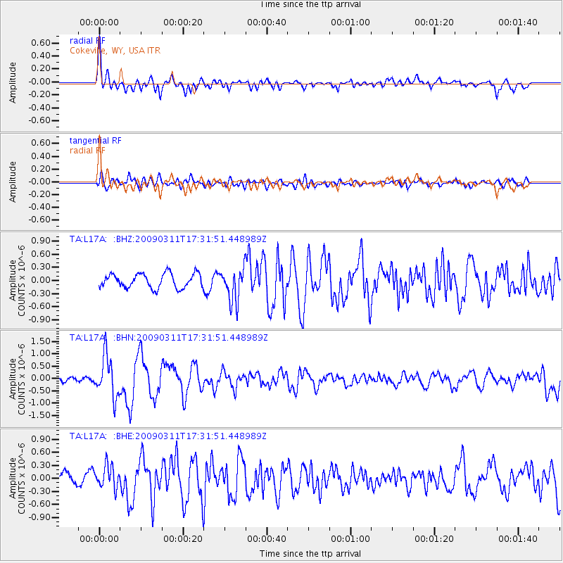
L17A Cokeville, WY, USA - Earthquake Result Viewer
*The percent match for this event was below the threshold and hence no stack was calculated.
| Earthquake location: |
Costa Rica |
| Earthquake latitude/longitude: |
8.5/-83.2 |
| Earthquake time(UTC): |
2009/03/11 (070) 17:24:36 GMT |
| Earthquake Depth: |
14 km |
| Earthquake Magnitude: |
5.8 MB, 5.6 MS, 5.9 MW, 5.9 MW |
| Earthquake Catalog/Contributor: |
WHDF/NEIC |
|
| Network: |
TA USArray Transportable Network (new EarthScope stations) |
| Station: |
L17A Cokeville, WY, USA |
| Lat/Lon: |
42.10 N/110.87 W |
| Elevation: |
1996 m |
|
| Distance: |
41.4 deg |
| Az: |
328.509 deg |
| Baz: |
136.029 deg |
| Ray Param: |
$rayparam |
*The percent match for this event was below the threshold and hence was not used in the summary stack. |
|
| Radial Match: |
69.900276 % |
| Radial Bump: |
400 |
| Transverse Match: |
63.29643 % |
| Transverse Bump: |
400 |
| SOD ConfigId: |
2658 |
| Insert Time: |
2010-03-06 23:01:57.767 +0000 |
| GWidth: |
2.5 |
| Max Bumps: |
400 |
| Tol: |
0.001 |
|
Signal To Noise
| Channel | StoN | STA | LTA |
| TA:L17A: :BHN:20090311T17:31:51.448989Z | 7.700074 | 8.5200696E-7 | 1.1064918E-7 |
| TA:L17A: :BHE:20090311T17:31:51.448989Z | 2.703528 | 2.6527866E-7 | 9.812314E-8 |
| TA:L17A: :BHZ:20090311T17:31:51.448989Z | 2.3962872 | 3.9074376E-7 | 1.6306215E-7 |
| Arrivals |
| Ps | |
| PpPs | |
| PsPs/PpSs | |


