You are here: Home > Network List > IU - Global Seismograph Network (GSN - IRIS/USGS) Stations List
> Station CTAO Charters Towers, Australia > Earthquake Result Viewer
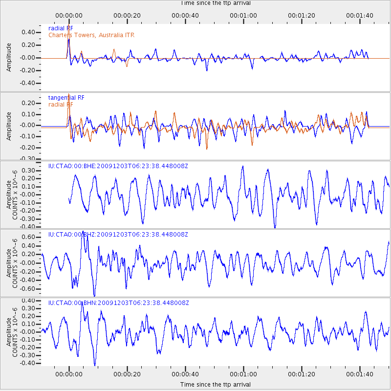
CTAO Charters Towers, Australia - Earthquake Result Viewer
*The percent match for this event was below the threshold and hence no stack was calculated.
| Earthquake location: |
Southern East Pacific Rise |
| Earthquake latitude/longitude: |
-56.5/-122.3 |
| Earthquake time(UTC): |
2009/12/03 (337) 06:12:32 GMT |
| Earthquake Depth: |
10 km |
| Earthquake Magnitude: |
5.5 MB, 5.8 MS, 6.0 MW, 6.0 MW |
| Earthquake Catalog/Contributor: |
WHDF/NEIC |
|
| Network: |
IU Global Seismograph Network (GSN - IRIS/USGS) |
| Station: |
CTAO Charters Towers, Australia |
| Lat/Lon: |
20.09 S/146.25 E |
| Elevation: |
357 m |
|
| Distance: |
74.3 deg |
| Az: |
257.466 deg |
| Baz: |
144.811 deg |
| Ray Param: |
$rayparam |
*The percent match for this event was below the threshold and hence was not used in the summary stack. |
|
| Radial Match: |
57.317684 % |
| Radial Bump: |
400 |
| Transverse Match: |
56.2243 % |
| Transverse Bump: |
400 |
| SOD ConfigId: |
1 |
| Insert Time: |
2010-02-19 01:18:37.826 +0000 |
| GWidth: |
2.5 |
| Max Bumps: |
400 |
| Tol: |
0.001 |
|
Signal To Noise
| Channel | StoN | STA | LTA |
| IU:CTAO:00:BHZ:20091203T06:23:38.448008Z | 2.5034096 | 3.8349816E-7 | 1.5319033E-7 |
| IU:CTAO:00:BHN:20091203T06:23:38.448008Z | 3.012033 | 2.0241988E-7 | 6.720374E-8 |
| IU:CTAO:00:BHE:20091203T06:23:38.448008Z | 0.8449232 | 1.1599022E-7 | 1.37279E-7 |
| Arrivals |
| Ps | |
| PpPs | |
| PsPs/PpSs | |


