You are here: Home > Network List > TA - USArray Transportable Network (new EarthScope stations) Stations List
> Station L17A Cokeville, WY, USA > Earthquake Result Viewer
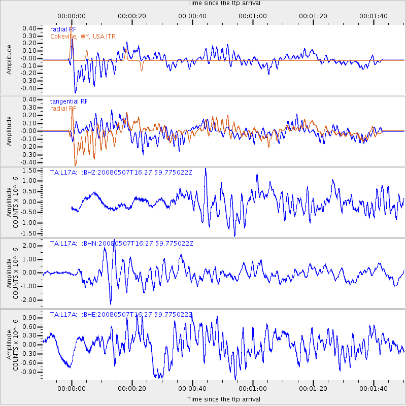
L17A Cokeville, WY, USA - Earthquake Result Viewer
*The percent match for this event was below the threshold and hence no stack was calculated.
| Earthquake location: |
Near East Coast Of Honshu, Japan |
| Earthquake latitude/longitude: |
36.2/141.8 |
| Earthquake time(UTC): |
2008/05/07 (128) 16:16:36 GMT |
| Earthquake Depth: |
23 km |
| Earthquake Magnitude: |
5.9 MB, 6.1 MW, 6.0 MW |
| Earthquake Catalog/Contributor: |
WHDF/NEIC |
|
| Network: |
TA USArray Transportable Network (new EarthScope stations) |
| Station: |
L17A Cokeville, WY, USA |
| Lat/Lon: |
42.10 N/110.87 W |
| Elevation: |
1996 m |
|
| Distance: |
77.7 deg |
| Az: |
46.625 deg |
| Baz: |
307.773 deg |
| Ray Param: |
$rayparam |
*The percent match for this event was below the threshold and hence was not used in the summary stack. |
|
| Radial Match: |
66.63377 % |
| Radial Bump: |
400 |
| Transverse Match: |
71.8179 % |
| Transverse Bump: |
400 |
| SOD ConfigId: |
2504 |
| Insert Time: |
2010-03-06 23:02:21.633 +0000 |
| GWidth: |
2.5 |
| Max Bumps: |
400 |
| Tol: |
0.001 |
|
Signal To Noise
| Channel | StoN | STA | LTA |
| TA:L17A: :BHN:20080507T16:27:59.775022Z | 3.424754 | 3.6616908E-7 | 1.06918364E-7 |
| TA:L17A: :BHE:20080507T16:27:59.775022Z | 1.7667696 | 3.8198277E-7 | 2.1620406E-7 |
| TA:L17A: :BHZ:20080507T16:27:59.775022Z | 0.6313057 | 1.5585796E-7 | 2.4688194E-7 |
| Arrivals |
| Ps | |
| PpPs | |
| PsPs/PpSs | |


