You are here: Home > Network List > TA - USArray Transportable Network (new EarthScope stations) Stations List
> Station M31M Drury Creek, Yukon, CA > Earthquake Result Viewer
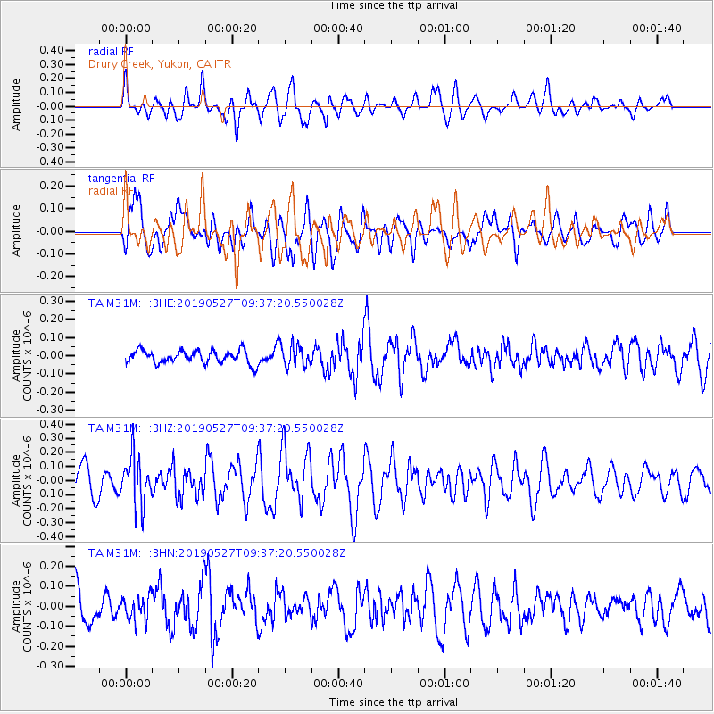
M31M Drury Creek, Yukon, CA - Earthquake Result Viewer
*The percent match for this event was below the threshold and hence no stack was calculated.
| Earthquake location: |
Solomon Islands |
| Earthquake latitude/longitude: |
-8.2/158.6 |
| Earthquake time(UTC): |
2019/05/27 (147) 09:25:20 GMT |
| Earthquake Depth: |
117 km |
| Earthquake Magnitude: |
5.5 mb |
| Earthquake Catalog/Contributor: |
NEIC PDE/us |
|
| Network: |
TA USArray Transportable Network (new EarthScope stations) |
| Station: |
M31M Drury Creek, Yukon, CA |
| Lat/Lon: |
62.20 N/134.39 W |
| Elevation: |
639 m |
|
| Distance: |
86.8 deg |
| Az: |
25.607 deg |
| Baz: |
245.866 deg |
| Ray Param: |
$rayparam |
*The percent match for this event was below the threshold and hence was not used in the summary stack. |
|
| Radial Match: |
68.74146 % |
| Radial Bump: |
400 |
| Transverse Match: |
67.20823 % |
| Transverse Bump: |
400 |
| SOD ConfigId: |
18369291 |
| Insert Time: |
2019-06-10 09:29:20.991 +0000 |
| GWidth: |
2.5 |
| Max Bumps: |
400 |
| Tol: |
0.001 |
|
Signal To Noise
| Channel | StoN | STA | LTA |
| TA:M31M: :BHZ:20190527T09:37:20.550028Z | 1.5670747 | 1.6653821E-7 | 1.0627331E-7 |
| TA:M31M: :BHN:20190527T09:37:20.550028Z | 0.8475871 | 5.952732E-8 | 7.023151E-8 |
| TA:M31M: :BHE:20190527T09:37:20.550028Z | 1.6919941 | 5.9948E-8 | 3.5430386E-8 |
| Arrivals |
| Ps | |
| PpPs | |
| PsPs/PpSs | |


