You are here: Home > Network List > GS - US Geological Survey Networks Stations List
> Station KAN10 Keim Farm > Earthquake Result Viewer
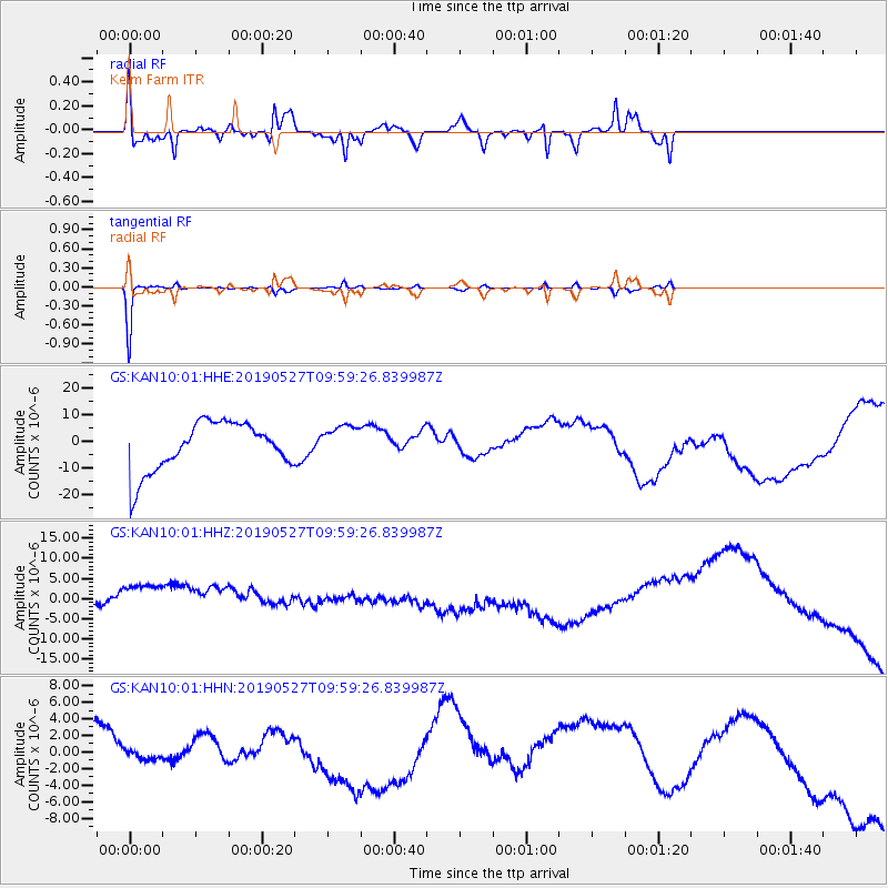
KAN10 Keim Farm - Earthquake Result Viewer
*The percent match for this event was below the threshold and hence no stack was calculated.
| Earthquake location: |
Kodiak Island Region, Alaska |
| Earthquake latitude/longitude: |
58.9/-152.4 |
| Earthquake time(UTC): |
2019/05/27 (147) 09:52:21 GMT |
| Earthquake Depth: |
65 km |
| Earthquake Magnitude: |
5.7 ML |
| Earthquake Catalog/Contributor: |
NEIC PDE/ak |
|
| Network: |
GS US Geological Survey Networks |
| Station: |
KAN10 Keim Farm |
| Lat/Lon: |
37.12 N/98.10 W |
| Elevation: |
417 m |
|
| Distance: |
40.9 deg |
| Az: |
97.605 deg |
| Baz: |
319.876 deg |
| Ray Param: |
$rayparam |
*The percent match for this event was below the threshold and hence was not used in the summary stack. |
|
| Radial Match: |
41.470512 % |
| Radial Bump: |
375 |
| Transverse Match: |
89.63002 % |
| Transverse Bump: |
134 |
| SOD ConfigId: |
18369291 |
| Insert Time: |
2019-06-10 09:54:28.511 +0000 |
| GWidth: |
2.5 |
| Max Bumps: |
400 |
| Tol: |
0.001 |
|
Signal To Noise
| Channel | StoN | STA | LTA |
| GS:KAN10:01:HHZ:20190527T09:59:26.839987Z | 1.2232989 | 8.466555E-6 | 6.921084E-6 |
| GS:KAN10:01:HHN:20190527T09:59:26.839987Z | 1.0669155 | 3.2193423E-6 | 3.0174294E-6 |
| GS:KAN10:01:HHE:20190527T09:59:26.839987Z | 0.7090959 | 6.532484E-6 | 9.212413E-6 |
| Arrivals |
| Ps | |
| PpPs | |
| PsPs/PpSs | |


