You are here: Home > Network List > TA - USArray Transportable Network (new EarthScope stations) Stations List
> Station L17A Cokeville, WY, USA > Earthquake Result Viewer
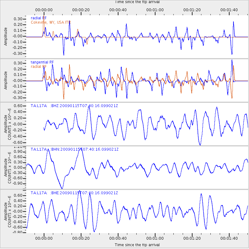
L17A Cokeville, WY, USA - Earthquake Result Viewer
*The percent match for this event was below the threshold and hence no stack was calculated.
| Earthquake location: |
Southeast Of Loyalty Islands |
| Earthquake latitude/longitude: |
-22.4/170.6 |
| Earthquake time(UTC): |
2009/01/15 (015) 07:27:20 GMT |
| Earthquake Depth: |
27 km |
| Earthquake Magnitude: |
5.8 MB, 6.5 MS, 6.7 MW, 6.6 MW |
| Earthquake Catalog/Contributor: |
WHDF/NEIC |
|
| Network: |
TA USArray Transportable Network (new EarthScope stations) |
| Station: |
L17A Cokeville, WY, USA |
| Lat/Lon: |
42.10 N/110.87 W |
| Elevation: |
1996 m |
|
| Distance: |
96.6 deg |
| Az: |
47.234 deg |
| Baz: |
245.954 deg |
| Ray Param: |
$rayparam |
*The percent match for this event was below the threshold and hence was not used in the summary stack. |
|
| Radial Match: |
70.41942 % |
| Radial Bump: |
400 |
| Transverse Match: |
64.728966 % |
| Transverse Bump: |
366 |
| SOD ConfigId: |
2834 |
| Insert Time: |
2010-03-06 23:02:46.491 +0000 |
| GWidth: |
2.5 |
| Max Bumps: |
400 |
| Tol: |
0.001 |
|
Signal To Noise
| Channel | StoN | STA | LTA |
| TA:L17A: :BHN:20090115T07:40:16.099021Z | 2.1115978 | 6.179759E-7 | 2.9265794E-7 |
| TA:L17A: :BHE:20090115T07:40:16.099021Z | 0.9972548 | 3.0899884E-7 | 3.0984944E-7 |
| TA:L17A: :BHZ:20090115T07:40:16.099021Z | 0.84459835 | 1.6228309E-7 | 1.9214232E-7 |
| Arrivals |
| Ps | |
| PpPs | |
| PsPs/PpSs | |


