
W20A Ramah, NM, USA - Earthquake Result Viewer

| ||||||||||||||||||
| ||||||||||||||||||
| ||||||||||||||||||
|
Signal To Noise
| Channel | StoN | STA | LTA |
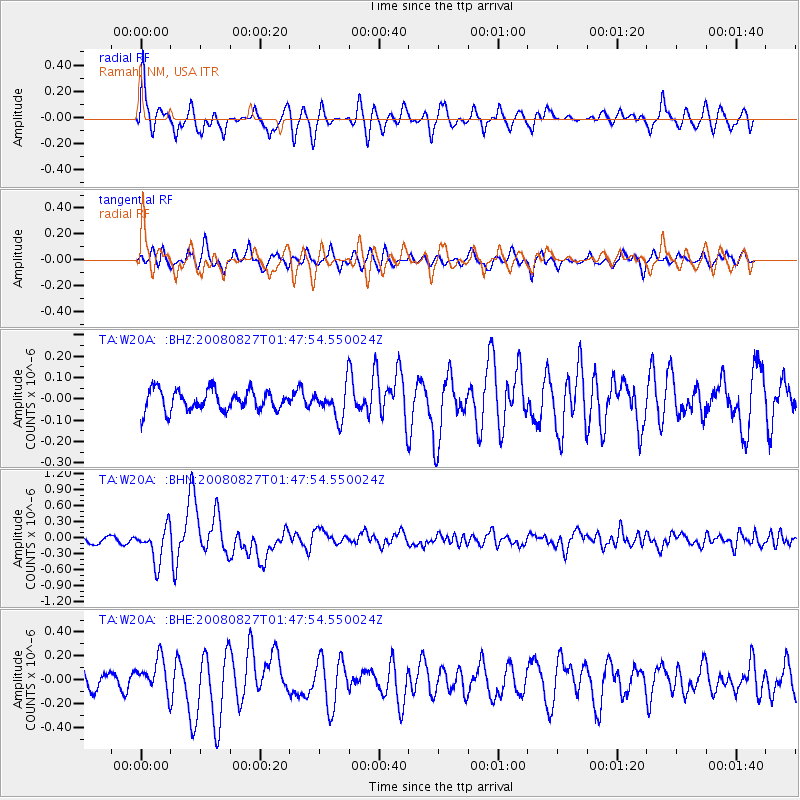
| TA:W20A: :BHN:20080827T01:47:54.550024Z | 5.7283773 | 3.291922E-7 | 5.7466924E-8 |
| TA:W20A: :BHE:20080827T01:47:54.550024Z | 1.690384 | 1.4031414E-7 | 8.300725E-8 |
| TA:W20A: :BHZ:20080827T01:47:54.550024Z | 1.5413358 | 7.455255E-8 | 4.836879E-8 |
| Arrivals | |
| Ps | 3.1 SECOND |
| PpPs | 8.5 SECOND |
| PsPs/PpSs | 12 SECOND |

