You are here: Home > Network List > TA - USArray Transportable Network (new EarthScope stations) Stations List
> Station W20A Ramah, NM, USA > Earthquake Result Viewer
W20A Ramah, NM, USA - Earthquake Result Viewer

| Earthquake location: |
Kuril Islands |
| Earthquake latitude/longitude: |
48.3/154.2 |
| Earthquake time(UTC): |
2009/09/10 (253) 02:46:50 GMT |
| Earthquake Depth: |
36 km |
| Earthquake Magnitude: |
6.0 MB, 5.5 MS, 6.0 MW, 5.8 MW |
| Earthquake Catalog/Contributor: |
WHDF/NEIC |
|
| Network: |
TA USArray Transportable Network (new EarthScope stations) |
| Station: |
W20A Ramah, NM, USA |
| Lat/Lon: |
35.13 N/108.50 W |
| Elevation: |
2110 m |
|
| Distance: |
69.1 deg |
| Az: |
60.501 deg |
| Baz: |
314.866 deg |
| Ray Param: |
0.055819638 |
| Estimated Moho Depth: |
44.5 km |
| Estimated Crust Vp/Vs: |
1.73 |
| Assumed Crust Vp: |
6.496 km/s |
| Estimated Crust Vs: |
3.755 km/s |
| Estimated Crust Poisson's Ratio: |
0.25 |
|
| Radial Match: |
87.45793 % |
| Radial Bump: |
384 |
| Transverse Match: |
77.45406 % |
| Transverse Bump: |
400 |
| SOD ConfigId: |
2622 |
| Insert Time: |
2010-03-06 23:03:53.790 +0000 |
| GWidth: |
2.5 |
| Max Bumps: |
400 |
| Tol: |
0.001 |
|
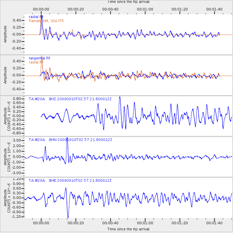
Signal To Noise
| Channel | StoN | STA | LTA |
| TA:W20A: :BHN:20090910T02:57:21.800012Z | 7.300532 | 6.354566E-7 | 8.704251E-8 |
| TA:W20A: :BHE:20090910T02:57:21.800012Z | 4.0596724 | 2.2519504E-7 | 5.5471233E-8 |
| TA:W20A: :BHZ:20090910T02:57:21.800012Z | 1.9177942 | 2.4303677E-7 | 1.2672724E-7 |
| Arrivals |
| Ps | 5.2 SECOND |
| PpPs | 18 SECOND |
| PsPs/PpSs | 23 SECOND |


