You are here: Home > Network List > II - Global Seismograph Network (GSN - IRIS/IDA) Stations List
> Station WRAB Tennant Creek, NT, Australia > Earthquake Result Viewer
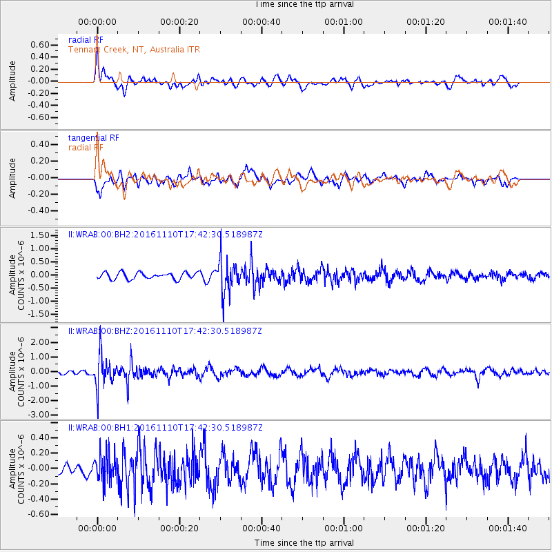
WRAB Tennant Creek, NT, Australia - Earthquake Result Viewer
*The percent match for this event was below the threshold and hence no stack was calculated.
| Earthquake location: |
Fiji Islands Region |
| Earthquake latitude/longitude: |
-20.4/-178.2 |
| Earthquake time(UTC): |
2016/11/10 (315) 17:35:38 GMT |
| Earthquake Depth: |
546 km |
| Earthquake Magnitude: |
5.6 MWW |
| Earthquake Catalog/Contributor: |
NEIC PDE/NEIC COMCAT |
|
| Network: |
II Global Seismograph Network (GSN - IRIS/IDA) |
| Station: |
WRAB Tennant Creek, NT, Australia |
| Lat/Lon: |
19.93 S/134.36 E |
| Elevation: |
366 m |
|
| Distance: |
44.4 deg |
| Az: |
262.017 deg |
| Baz: |
99.149 deg |
| Ray Param: |
$rayparam |
*The percent match for this event was below the threshold and hence was not used in the summary stack. |
|
| Radial Match: |
66.00344 % |
| Radial Bump: |
400 |
| Transverse Match: |
70.016556 % |
| Transverse Bump: |
400 |
| SOD ConfigId: |
1858631 |
| Insert Time: |
2016-11-28 15:40:43.559 +0000 |
| GWidth: |
2.5 |
| Max Bumps: |
400 |
| Tol: |
0.001 |
|
Signal To Noise
| Channel | StoN | STA | LTA |
| II:WRAB:00:BHZ:20161110T17:42:30.518987Z | 8.948271 | 1.0775757E-6 | 1.2042278E-7 |
| II:WRAB:00:BH1:20161110T17:42:30.518987Z | 1.9346263 | 1.8076055E-7 | 9.343435E-8 |
| II:WRAB:00:BH2:20161110T17:42:30.518987Z | 5.0653324 | 6.322022E-7 | 1.2480962E-7 |
| Arrivals |
| Ps | |
| PpPs | |
| PsPs/PpSs | |


