W20A Ramah, NM, USA - Earthquake Result Viewer
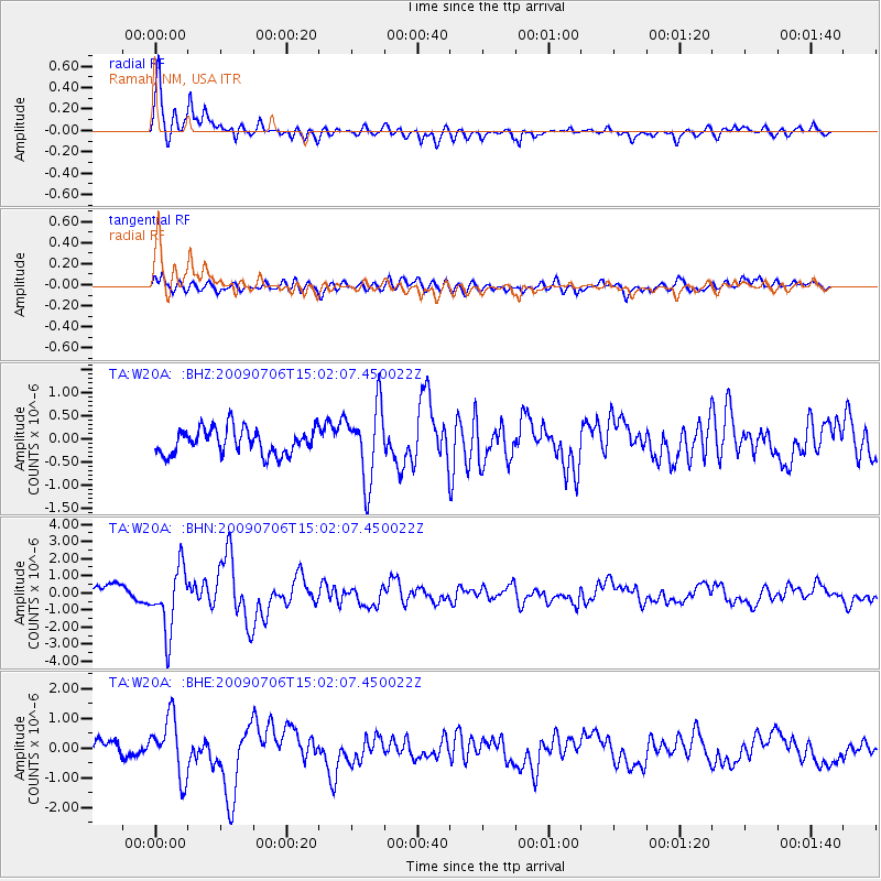
Earthquake location: Rat Islands, Aleutian Islands
Earthquake latitude/longitude: 50.4/177.0
Earthquake time(UTC): 2009/07/06 (187) 14:53:12 GMT
Earthquake Depth: 22 km
Earthquake Magnitude: 6.0 MB, 5.8 MS, 6.1 MW, 6.0 MW
Earthquake Catalog/Contributor: WHDF/NEIC
Network: TA USArray Transportable Network (new EarthScope stations)
Station: W20A Ramah, NM, USA
Lat/Lon: 35.13 N/108.50 W
Elevation: 2110 m
Distance: 54.5 deg
Az: 75.93 deg
Baz: 310.821 deg
Ray Param: 0.065366365
Estimated Moho Depth: 37.75 km
Estimated Crust Vp/Vs: 1.87
Assumed Crust Vp: 6.496 km/s
Estimated Crust Vs: 3.478 km/s
Estimated Crust Poisson's Ratio: 0.30
Radial Match: 86.4623 %
Radial Bump: 400
Transverse Match: 66.19038 %
Transverse Bump: 400
SOD ConfigId: 2648
Insert Time: 2010-03-06 23:04:30.246 +0000
GWidth: 2.5
Max Bumps: 400
Tol: 0.001

Signal To Noise

ChannelStoNSTALTA
TA:W20A: :BHN:20090706T15:02:07.450022Z4.83072231.8556615E-63.8413748E-7
TA:W20A: :BHE:20090706T15:02:07.450022Z3.38096439.821712E-72.905003E-7
TA:W20A: :BHZ:20090706T15:02:07.450022Z2.8934988.050259E-72.7821892E-7
Arrivals
Ps5.3 SECOND
PpPs16 SECOND
PsPs/PpSs21 SECOND