W20A Ramah, NM, USA - Earthquake Result Viewer
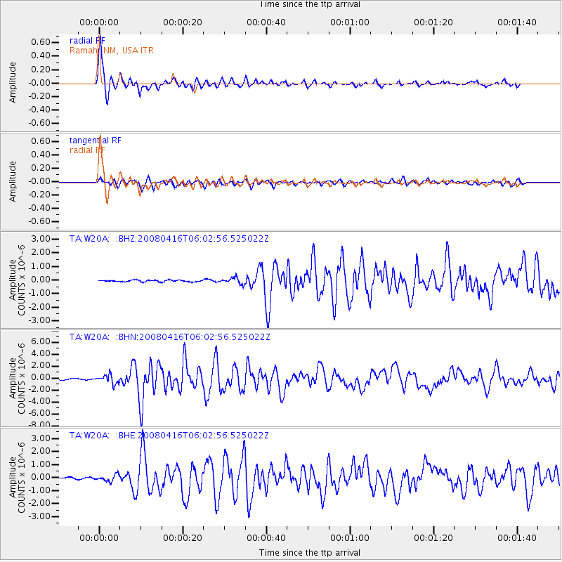
Earthquake location: Andreanof Islands, Aleutian Is.
Earthquake latitude/longitude: 51.9/-179.2
Earthquake time(UTC): 2008/04/16 (107) 05:54:19 GMT
Earthquake Depth: 13 km
Earthquake Magnitude: 6.1 MB, 6.5 MS, 6.6 MW, 6.6 MW
Earthquake Catalog/Contributor: WHDF/NEIC
Network: TA USArray Transportable Network (new EarthScope stations)
Station: W20A Ramah, NM, USA
Lat/Lon: 35.13 N/108.50 W
Elevation: 2110 m
Distance: 51.9 deg
Az: 79.589 deg
Baz: 311.944 deg
Ray Param: 0.06713375
Estimated Moho Depth: 15.75 km
Estimated Crust Vp/Vs: 2.10
Assumed Crust Vp: 6.496 km/s
Estimated Crust Vs: 3.097 km/s
Estimated Crust Poisson's Ratio: 0.35
Radial Match: 97.29706 %
Radial Bump: 389
Transverse Match: 88.24844 %
Transverse Bump: 400
SOD ConfigId: 2504
Insert Time: 2010-03-06 23:04:48.523 +0000
GWidth: 2.5
Max Bumps: 400
Tol: 0.001

Signal To Noise

ChannelStoNSTALTA
TA:W20A: :BHN:20080416T06:02:56.525022Z4.96426637.4230326E-71.495293E-7
TA:W20A: :BHE:20080416T06:02:56.525022Z2.60410432.4890764E-79.558283E-8
TA:W20A: :BHZ:20080416T06:02:56.525022Z4.02268652.2666987E-75.6347886E-8
Arrivals
Ps2.8 SECOND
PpPs7.2 SECOND
PsPs/PpSs9.9 SECOND