You are here: Home > Network List > TA - USArray Transportable Network (new EarthScope stations) Stations List
> Station W20A Ramah, NM, USA > Earthquake Result Viewer
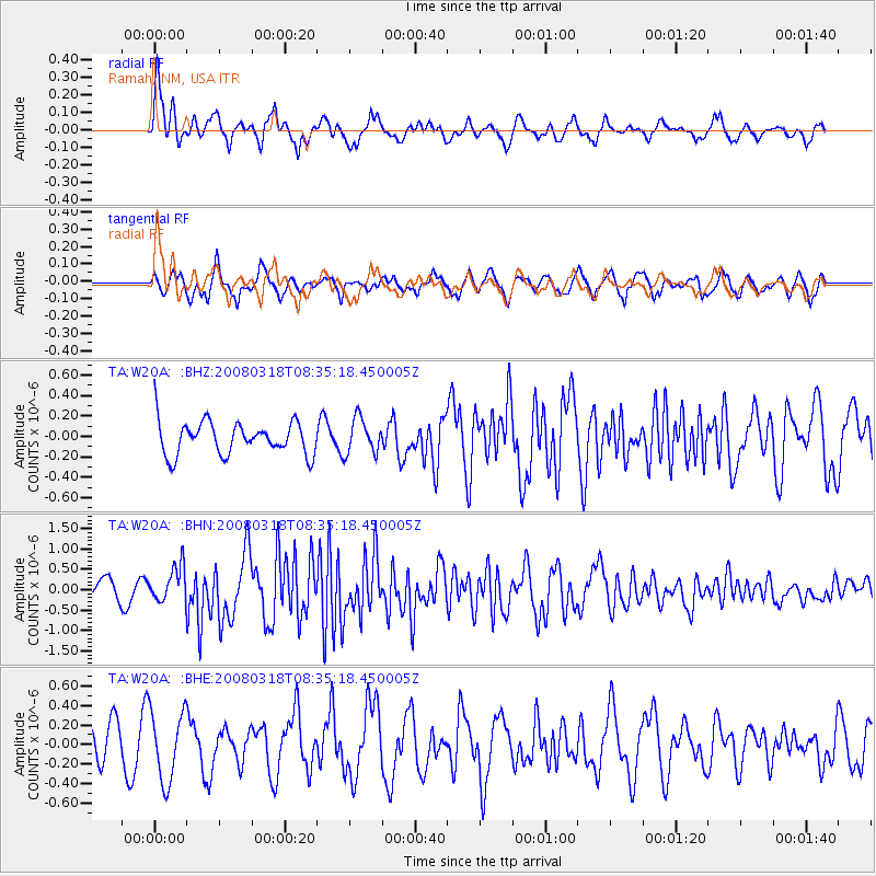
W20A Ramah, NM, USA - Earthquake Result Viewer
*The percent match for this event was below the threshold and hence no stack was calculated.
| Earthquake location: |
Kermadec Islands, New Zealand |
| Earthquake latitude/longitude: |
-29.3/-177.4 |
| Earthquake time(UTC): |
2008/03/18 (078) 08:22:47 GMT |
| Earthquake Depth: |
25 km |
| Earthquake Magnitude: |
5.8 MB, 6.1 MS, 6.2 MW, 6.2 MW |
| Earthquake Catalog/Contributor: |
WHDF/NEIC |
|
| Network: |
TA USArray Transportable Network (new EarthScope stations) |
| Station: |
W20A Ramah, NM, USA |
| Lat/Lon: |
35.13 N/108.50 W |
| Elevation: |
2110 m |
|
| Distance: |
91.2 deg |
| Az: |
49.918 deg |
| Baz: |
234.655 deg |
| Ray Param: |
$rayparam |
*The percent match for this event was below the threshold and hence was not used in the summary stack. |
|
| Radial Match: |
76.27901 % |
| Radial Bump: |
375 |
| Transverse Match: |
64.73336 % |
| Transverse Bump: |
388 |
| SOD ConfigId: |
2504 |
| Insert Time: |
2010-03-06 23:05:05.316 +0000 |
| GWidth: |
2.5 |
| Max Bumps: |
400 |
| Tol: |
0.001 |
|
Signal To Noise
| Channel | StoN | STA | LTA |
| TA:W20A: :BHN:20080318T08:35:18.450005Z | 2.2336776 | 4.383395E-7 | 1.9624116E-7 |
| TA:W20A: :BHE:20080318T08:35:18.450005Z | 1.864797 | 3.5826287E-7 | 1.9211895E-7 |
| TA:W20A: :BHZ:20080318T08:35:18.450005Z | 1.0745008 | 1.7313968E-7 | 1.61135E-7 |
| Arrivals |
| Ps | |
| PpPs | |
| PsPs/PpSs | |


