You are here: Home > Network List > TS - TERRAscope (Southern California Seismic Network) Stations List
> Station GPO China Lake , California, USA > Earthquake Result Viewer
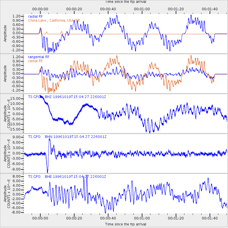
GPO China Lake , California, USA - Earthquake Result Viewer
*The percent match for this event was below the threshold and hence no stack was calculated.
| Earthquake location: |
Fiji Islands Region |
| Earthquake latitude/longitude: |
-20.4/-178.5 |
| Earthquake time(UTC): |
1996/10/19 (293) 14:53:48 GMT |
| Earthquake Depth: |
591 km |
| Earthquake Magnitude: |
6.1 MB, 6.9 UNKNOWN, 6.8 MW |
| Earthquake Catalog/Contributor: |
WHDF/NEIC |
|
| Network: |
TS TERRAscope (Southern California Seismic Network) |
| Station: |
GPO China Lake , California, USA |
| Lat/Lon: |
35.65 N/117.66 W |
| Elevation: |
735 m |
|
| Distance: |
80.2 deg |
| Az: |
46.212 deg |
| Baz: |
236.243 deg |
| Ray Param: |
$rayparam |
*The percent match for this event was below the threshold and hence was not used in the summary stack. |
|
| Radial Match: |
32.1693 % |
| Radial Bump: |
353 |
| Transverse Match: |
43.109932 % |
| Transverse Bump: |
400 |
| SOD ConfigId: |
4480 |
| Insert Time: |
2010-02-26 14:14:29.641 +0000 |
| GWidth: |
2.5 |
| Max Bumps: |
400 |
| Tol: |
0.001 |
|
Signal To Noise
| Channel | StoN | STA | LTA |
| TS:GPO: :BHN:19961019T15:04:27.226001Z | 4.414666 | 3.7380728E-6 | 8.467396E-7 |
| TS:GPO: :BHE:19961019T15:04:27.226001Z | 0.8410235 | 2.1716378E-6 | 2.5821369E-6 |
| TS:GPO: :BHZ:19961019T15:04:27.226001Z | 0.7562942 | 6.0962234E-6 | 8.0606505E-6 |
| Arrivals |
| Ps | |
| PpPs | |
| PsPs/PpSs | |


