You are here: Home > Network List > TS - TERRAscope (Southern California Seismic Network) Stations List
> Station GPO China Lake , California, USA > Earthquake Result Viewer
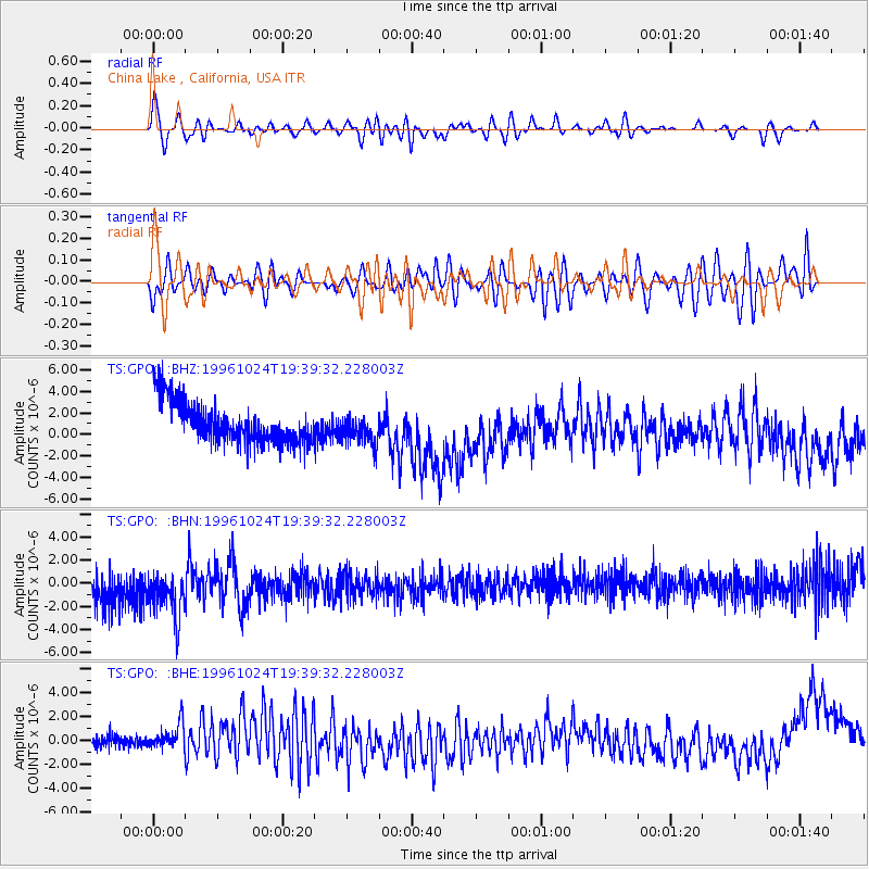
GPO China Lake , California, USA - Earthquake Result Viewer
*The percent match for this event was below the threshold and hence no stack was calculated.
| Earthquake location: |
Near N. Coast Of Eastern Siberia |
| Earthquake latitude/longitude: |
67.0/-173.2 |
| Earthquake time(UTC): |
1996/10/24 (298) 19:31:53 GMT |
| Earthquake Depth: |
20 km |
| Earthquake Magnitude: |
6.0 MB, 5.9 MS, 6.1 UNKNOWN, 5.8 ME |
| Earthquake Catalog/Contributor: |
WHDF/NEIC |
|
| Network: |
TS TERRAscope (Southern California Seismic Network) |
| Station: |
GPO China Lake , California, USA |
| Lat/Lon: |
35.65 N/117.66 W |
| Elevation: |
735 m |
|
| Distance: |
44.4 deg |
| Az: |
106.21 deg |
| Baz: |
332.382 deg |
| Ray Param: |
$rayparam |
*The percent match for this event was below the threshold and hence was not used in the summary stack. |
|
| Radial Match: |
50.20876 % |
| Radial Bump: |
400 |
| Transverse Match: |
31.193485 % |
| Transverse Bump: |
400 |
| SOD ConfigId: |
4480 |
| Insert Time: |
2010-02-26 14:14:30.085 +0000 |
| GWidth: |
2.5 |
| Max Bumps: |
400 |
| Tol: |
0.001 |
|
Signal To Noise
| Channel | StoN | STA | LTA |
| TS:GPO: :BHN:19961024T19:39:32.228003Z | 1.0568613 | 4.0908108E-6 | 3.8707167E-6 |
| TS:GPO: :BHE:19961024T19:39:32.228003Z | 2.1383002 | 1.2486912E-6 | 5.839644E-7 |
| TS:GPO: :BHZ:19961024T19:39:32.228003Z | 0.7535957 | 1.4358313E-6 | 1.9053073E-6 |
| Arrivals |
| Ps | |
| PpPs | |
| PsPs/PpSs | |


